
Mapping as a tool for the development of pasture use plans (in the frame of CACILM)
Type: Approaches
Creation: 2013-01-15 00:00 Updated: 2017-08-17 11:54
Compilers: Azamat Isakov
Reviewers: Alexandra Gavilano, David Streiff
Country/ region/ locations where the Approach has been applied
- Country: Kyrgyzstan
- Region/ State/ Province: Naryn oblast
- Further specification of location (e.g. municipality, town, etc.), if relevant: – Naryn rayon – Jergetal, Minbulak, Onarsha, Kazan-Kuygan, Emgekchil ail okrugs
- Map: View Map
Description of the SLM Approach
Short description of the Approach
Mapping (development of pasture area maps) for the use of pastures with the participation of all stakeholders, as a basis for a balanced distribution of cattle depending on the capacity and seasonality of the pastures (in the frame of CACIM).
Detailed description of the Approach
Aims / objectives: Reduction / prevention of pasture degradation by mapping pasture areas, followed by the development of pasture use plans based on the elaborated maps.
Stages of implementation: Mapping of pastures allows the Pasture Committees to assess the carrying capacity of each pasture area, and to develop a plan for their use on its basis. Implementing or following the pasture use plan by pasture users leads to the following results: а) prevention and reduction of pasture degradation; b) reduction of conflicts over pasture resources between different groups of pasture users based on the established boundaries of pasture areas and timing of seasonal grazing; c) increase in the income of local farmers by improving the condition of livestock.
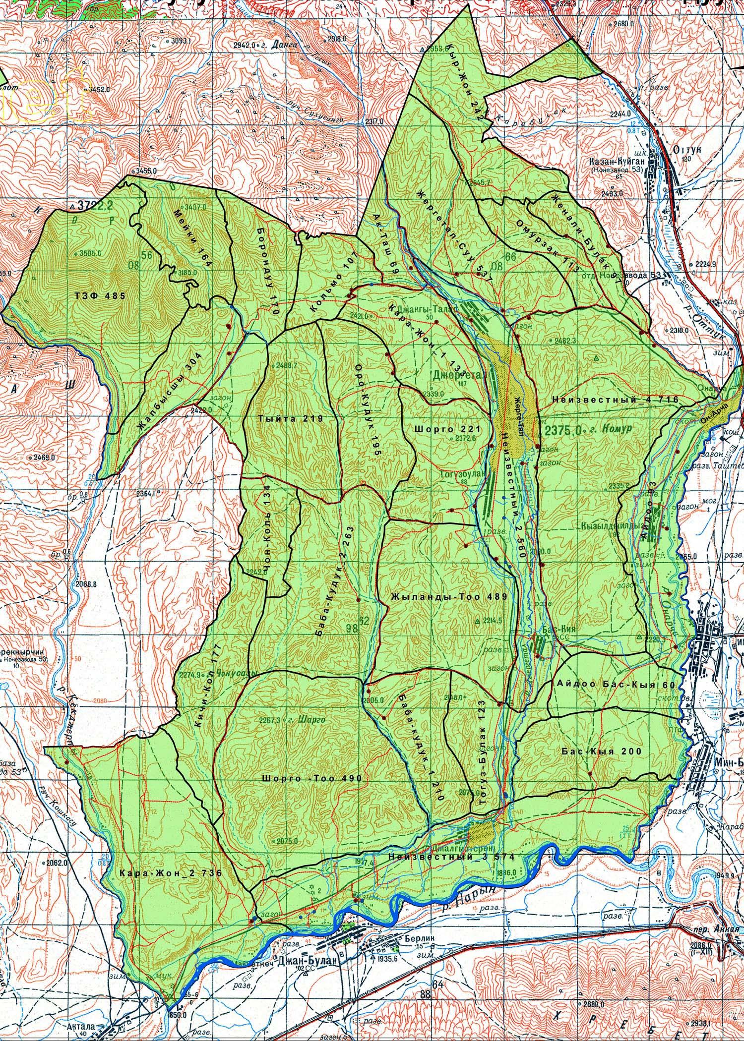
The implementation of this approach should be started with the collection of the available map materials of the aiyl okrug (A/O, aiyl okrug is an administrative and territorial unit consists of a group of villages, which has a local self-government), followed by the digitization of geobotanical maps of the pastures using the program Arc GIS 9 and specifying in the table of attributes the vegetation types, the gross production (phytomass per hectare), edible productivity. Among others, recommendations for the seasonal use of pastures are then being developed (this work was carried out by specialists of CAMP Alatoo PF). PastureCommittees first define the external borders of their pastures using old maps from the Soviet period. The newly established borders of pastures shall be agreed with neighboring aiyl okrugs. Where there are disputed territories consensus has to be achieved. Then, Pasture Committees determine the internal borders of pasture areas traditionally used by farmers. The natural barriers (rivers, ridges, rocks, etc.) usually serve as boundaries of the areas. Borders of pasture areas determined by the Pasture Committee are plotted on the geobotanical map. Based on this map, which shows the types of pastures in different pasture areas, the capacity of each pasture area is calculated. To obtain the capacity of the pasture areas in different seasons, the total capacity is multiplied by the coefficients for each season, which are defined and presented by Kyrgyz Designing Institute on Land Management “Kyrgyzgiprozem”. The results obtained will be plotted on four simple maps representing the carrying capacity of the pasture areas in spring, summer, autumn and winter. These maps are then used by the Pasture Committee for the development of their pasture use plans.
Role of stakeholders: Pasture use plans which are based on the mapping of pasture areas become binding for all pasture users after the approval by the general meeting of the Association of pasture users and the aiyl kenesh. (local authority) Accordingly, the meeting represents and defends the interests of the majority of pasture users, which represents both men and women.
Other important information: This approach has been implemented by CAMP Alatoo PF as part of a pilot project of the GIZ regional program “Sustainable Use of Natural Resources in Central Asia”.
Photos of the Approach
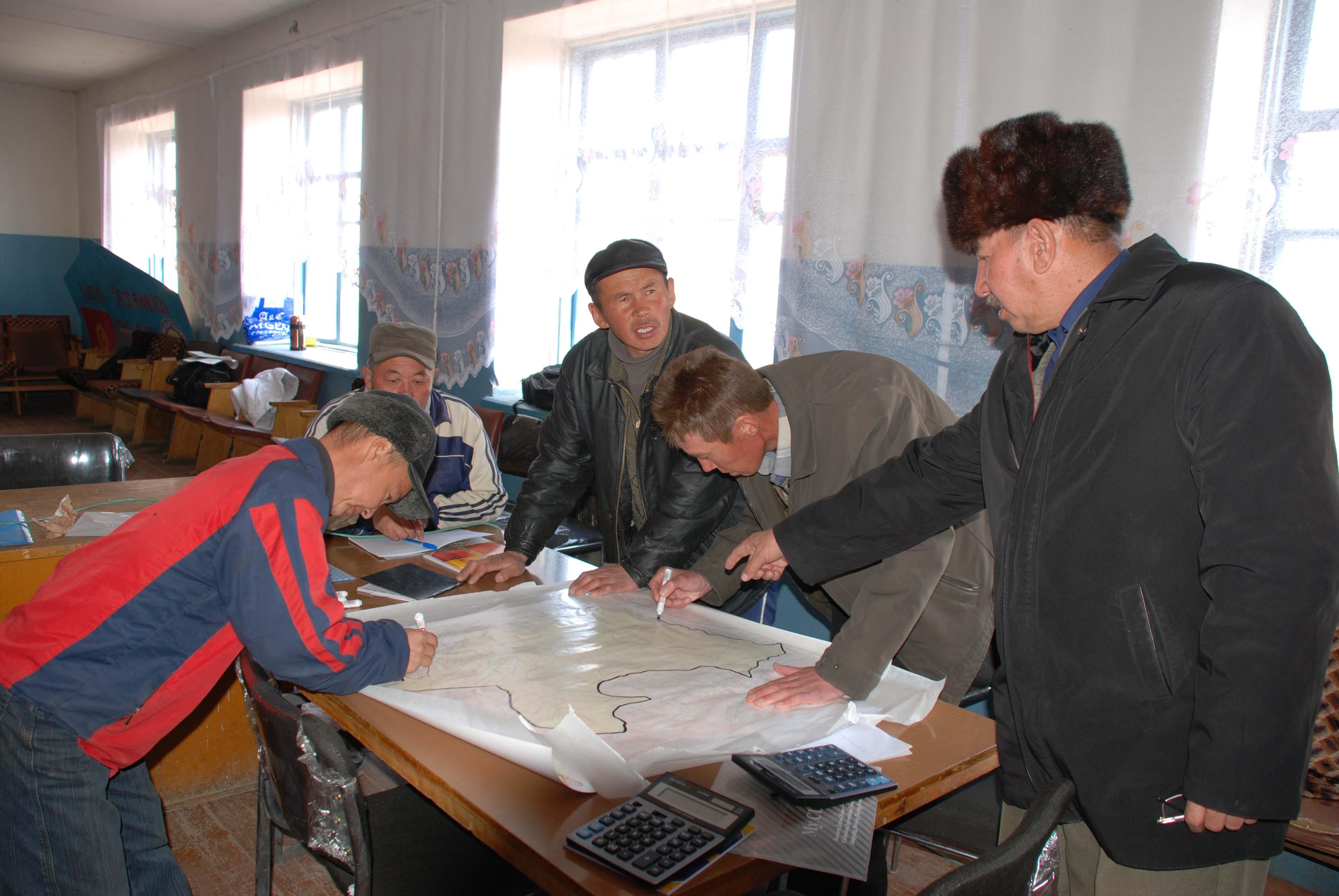
- 📍 Jergatal village, Naryn province
- 🗓 2009-01-11
- 📷 Archives of САМР Alatoo (3, Uphimskiy pereulok, Bishkek)
- 📍 Jergatal village, Naryn province
- 📷 Archives of САМР Alatoo (3, Uphimskiy pereulok, Bishkek)