
Pasture inclination used for developing grazing plan
Type: Approaches
Creation: 2018-03-26 21:20 Updated: 2024-08-22 08:58
Compilers: Askarsho Zevarshoev
Reviewers: Maximilian Knoll, Yacime Khadraoui, Joana Eichenberger
Country/ region/ locations where the Approach has been applied
- Country: Tajikistan
- Region/ State/ Province: Central Asia/Tajikistan/Rasht Valley
- Map: View Map
Description of the SLM Approach
Short description of the Approach
In this approach the inclination of pasture land and its effect on the spread of sun and shadow is used to identify different periods for grazing. This simple approach will raise awareness and provides biological aspects in pasture management. In this approach the vegetation cover of the pasture is linked to the position of the sun. This is specific to mountain areas, where in one location vegetation periods can differ in two spots although they are in the same location.
Detailed description of the Approach
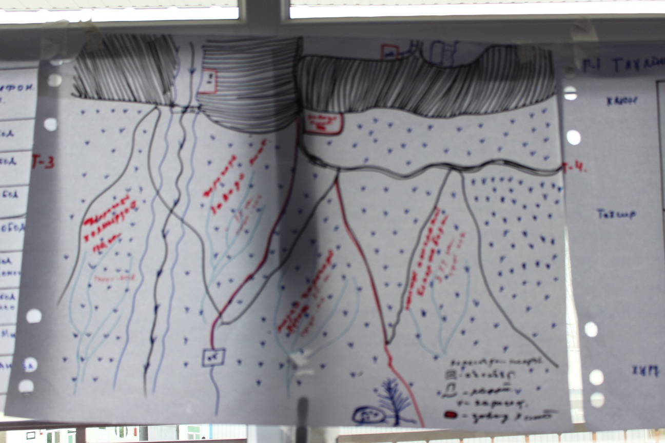
Considering pasture's geographical location and its inclination to the sun is identified as an important element of devoloping rotational grazing plans. Because of the mountainous geography of the area, within certain pasture areas one part can be sun inclined and the other is shadowed. This is effecting the vegetation growing process, since on the sun inclined part the vegetation is growing faster compared to the other where sun is reaching later. Communities in the past did not take this into consideration and grazed in both areas at the same time. This leads to degradation in the areas where vegetation did not grow properly. On the other side if the areas inclined to the sun are not grazed in time they dry up.
The main objective of this approach is to apply an ecosystem based adaptation approach in pasture use, with vegetative periods for different areas and locations. By applying this approach communities will be enabled to organize grazing plans correctly and to prevent pasture degradation.
The implementation period will start from the planing phase up to the implementation of the pasture plan. Mainly livestock owners and the PUU management is involved in the implementation of this approach. Pasture users will be mobilized according to the grazing plan, in which part of the pasture when to graze with taking into consideration the position to the sun. Beside land users, the local government is also involved to ensure sustainable use of this approach as one of the techniques in prevention of pasture degradation.
Based on the existing traditional community knowledge and experiences the communities identify the geographical location. Based on this knowledge while developing the grazing plan for the year in a meeting in a participatory manner they do community resource mapping, where the location of resources is provided. After preparing the community resource maps, especially with focus on pasture resources they mark the plots according to assigned attributes. Based on these attributes, where the important features is pasture exposition, a timeframe for grazing for each plot is set up.
Livestock owners are very much in favor to implement this approach as a simple method to prevent degradation and raising awareness on importance of periodic and systematic use of pasture lands. It was not well perceived well by some individual livestock owners, who abused the absence of grazing plans and benefited from early use of grazing without considering the degradation of the pastures.
Photos of the Approach
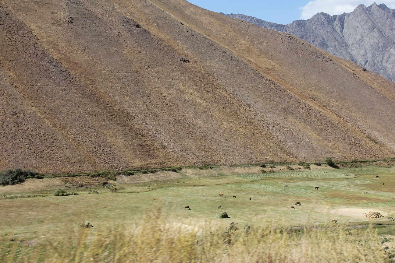
- 📍 Lakhsh District
- 📷 Zevarshoev Askarsho
- 📍 Lakhsh District, Rasht Valley
- 📷 Zevarshoev Askarsho