
Integrated Pasture Management Planning in Mountainous Regions
Type: Approaches
Creation: 2019-08-27 11:32 Updated: 2020-08-21 17:03
Compilers: Hanns Kirchmeir
Reviewers: Rima Mekdaschi Studer
Country/ region/ locations where the Approach has been applied
- Country: Georgia
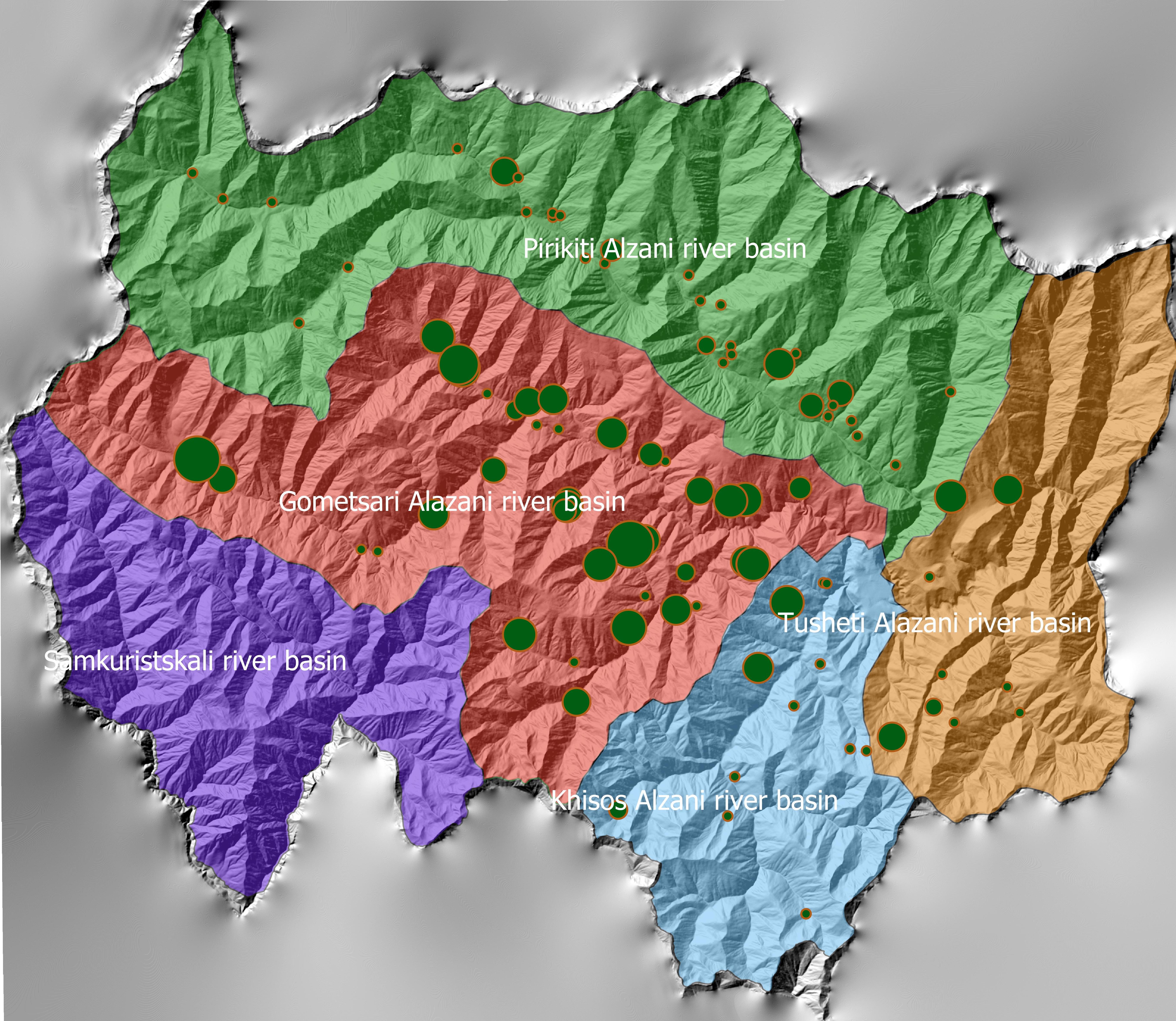
- Region/ State/ Province: Tusheti
- Further specification of location (e.g. municipality, town, etc.), if relevant: Entire territory of Tusheti Protected Areas (1100 km²)
- Map: View Map
Description of the SLM Approach
Short description of the Approach
The unsustainable use of pastures and forest areas has led to soil erosion, degradation, desertification and loss of biodiversity in the high mountain areas of the South Caucasus. The development of pasture passports is part of a broader approach to a strategic pasture management plan for Tusheti. This showcase includes results from the spatial planning process applied in a pilot programme for Akhmeta municipality.
Detailed description of the Approach
Project area and purpose
The project area comprises the Tusheti Protected Areas (PAs) on the northern slopes of the Greater Caucasus Mountains in Georgia. This group of protected areas consists of a strict nature reserve, a national park and a protected landscape with about 40 villages and settlements. Together they form a total protected area of approx. 114,000 ha. In Tusheti, overgrazing has led, especially in the eastern part with a higher number of villages and roads, to soil erosion and biodiversity loss. Especially the intensive use of summer pastures during the Soviet period resulted in a severe deterioration of the mountain slopes. So far, there are no standards or guidelines for the elaboration of sustainable pasture management plans in Georgia. Pasture passports, as a first step towards sustainable pasture management, document the actual grazing capacity for each pasture unit and serve as a guiding document for shepherds and local stakeholders and as a basis to prepare lease contracts.
Data gathering
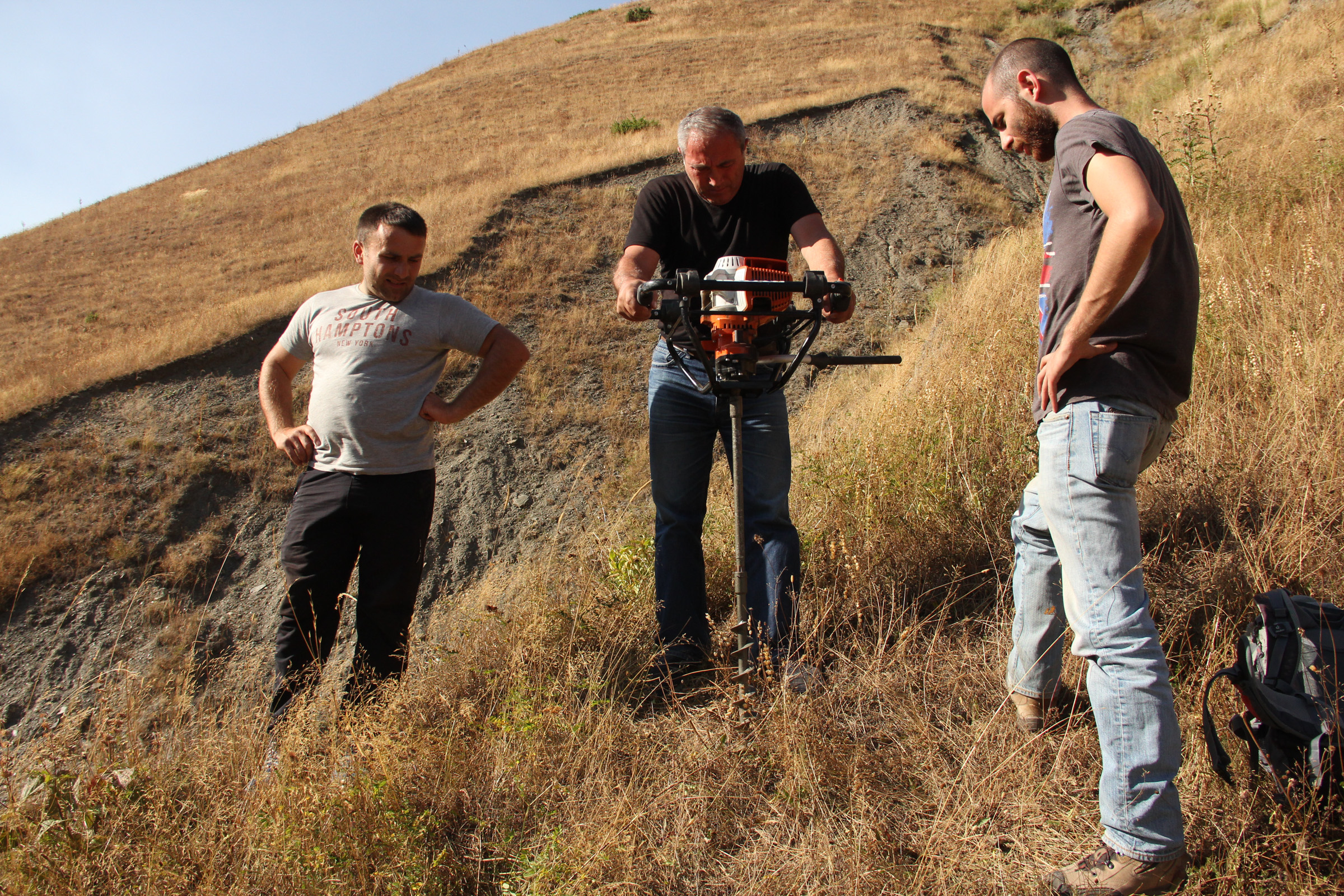
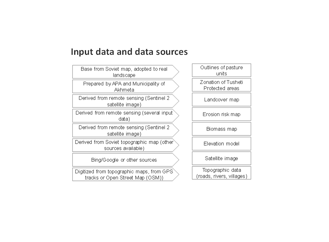
As a prerequisite for the development of pasture passports and the calculation of grazing capacity, the type of land cover, the erosion risk and the biomass of the pastureland had to be assessed for each pasture unit. This was done using remote sensing tools in combination with data collected in the field for calibration.
The details on the methodology of the Land Cover & Biomass as well as the Erosion Risk Assessment can be found in the WOCAT technology on "Remote Sensing as a Tool for Land Degradation Neutrality Monitoring" (see link).
Evaluation and Ground Truthing
All interim results have been checked and evaluated by local stakeholders, national experts and experts from local administrations. It was important not only to conduct workshops in seminar rooms but to meet the local stakeholders in the field and to discuss the problems and challenges of pasture management on place in the field. At this workshops all levels of decision makers were included (Ministries, Donor organisations, international and national experts, local administrations and land users). This was important to create a common understanding of the current situation from different perspectives (nature conservation, administration, shepherds ...). The combination of remote sensing with calibration data from the field can be summarised as a very effective method to assess the erosion state in large areas. Neither of the two instruments would be able to provide results in this spatial dimension and quality alone.
Pasture Passports
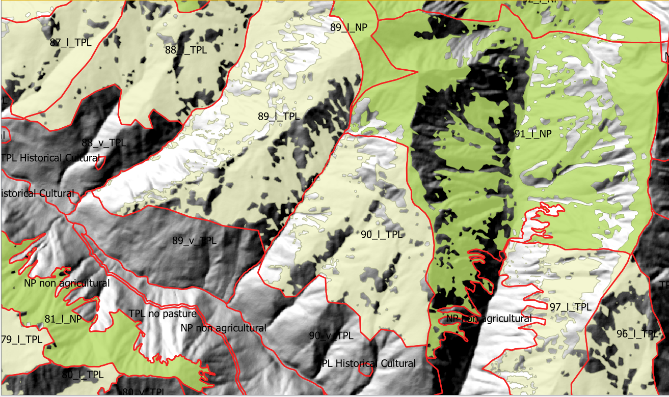
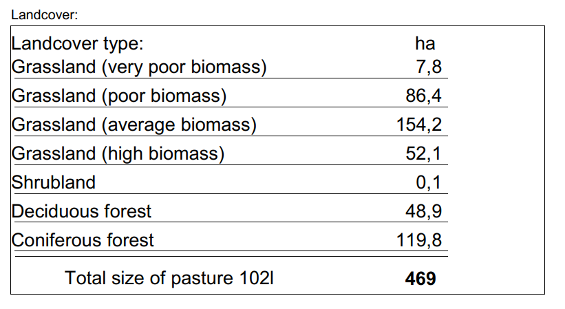
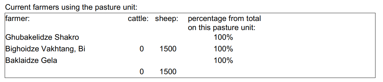
As part of the spatial planning of Akhmeta municipality, pastureland that can be leased to shepherds was separated from land used as hay meadows, farmland or pastures belonging to the villagers. The resulting map shows land available to the village and land available for lease. To understand the current use of pastureland, farms, livestock numbers and pasture units were assessed. In workshops with the local stakeholders and potential users of the results (shepherds, Tusheti Protected Landscape Administration, Tusheti NP Administration, APA), the design of the pasture passports was developed. Each pasture unit is described on four pages in the pasture passport.
Each pasture unit is described on four pages in the pasture passport: Header: the number (code), total area; content: map of the land cover types, the area of each land cover type, map of available biomass and carrying capacity, name of farmers/shepherds and their livestock numbers using the pasture unit
Spatial Planning Department and Construction Policy (within the Ministry of Regional Development and Infrastructure MRDI), and the Agency of Protected Areas APA (within the Ministry of Environmental Protection and Agriculture MEPA), are key stakeholders to use the pasture passports and to further develop and upscale this approach to other protected areas in Georgia. Beside APA, the Tusheti Protected Landscape Administration (TPLA), located within the Akhmeta municipality administration, is the second important user of pasture passports.
The pasture passports are showing not only the boundaries of each pasture unit, but also those areas that must not be grazed because this lands are part of strict protected areas or areas of high erosion risk. This helps shepherds to guide their flocks to the right places and the park rangers to check, if the regulations are respected correctly.
Photos of the Approach
- 📍 Tusheti Protected Areas
- 📷 Hanns Kirchmeir
- 📷 Hanns Kirchmeir
- 📍 Tusheti Protected Areas
- 📷 Hanns Kirchmeir
- 📍 Tusheti Protected Areas
- 📷 Hanns Kirchmeir
- 📷 Hanns Kirchmeir
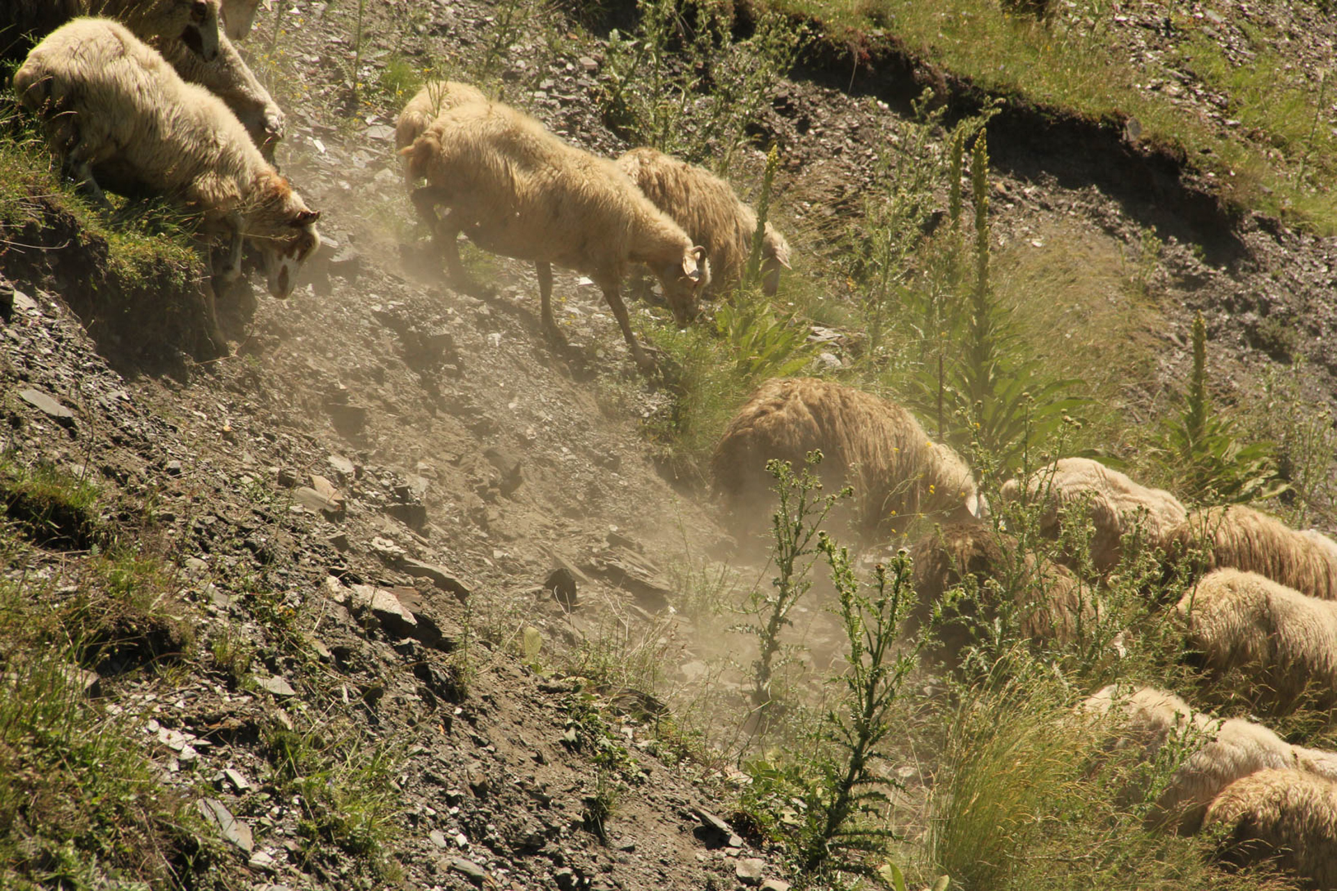
- 📍 Tusheti Protected Areas
- 🗓 2015-01-07
- 📷 Hanns Kirchmeir
- 📷 Hanns Kirchmeir