
Restoration of degraded lands through participatory land use planning
Type: Approaches
Creation: 2022-04-25 11:15 Updated: 2022-05-13 14:22
Compilers: Head Soil Science
Reviewers: William Critchley, Rima Mekdaschi Studer
Country/ region/ locations where the Approach has been applied
- Country: Sri Lanka
- Region/ State/ Province: Badulla District - Uva province
- Further specification of location (e.g. municipality, town, etc.), if relevant: Watagamuwa Grama Niladhari Division, Bandarawela Divisional Secretariat Division
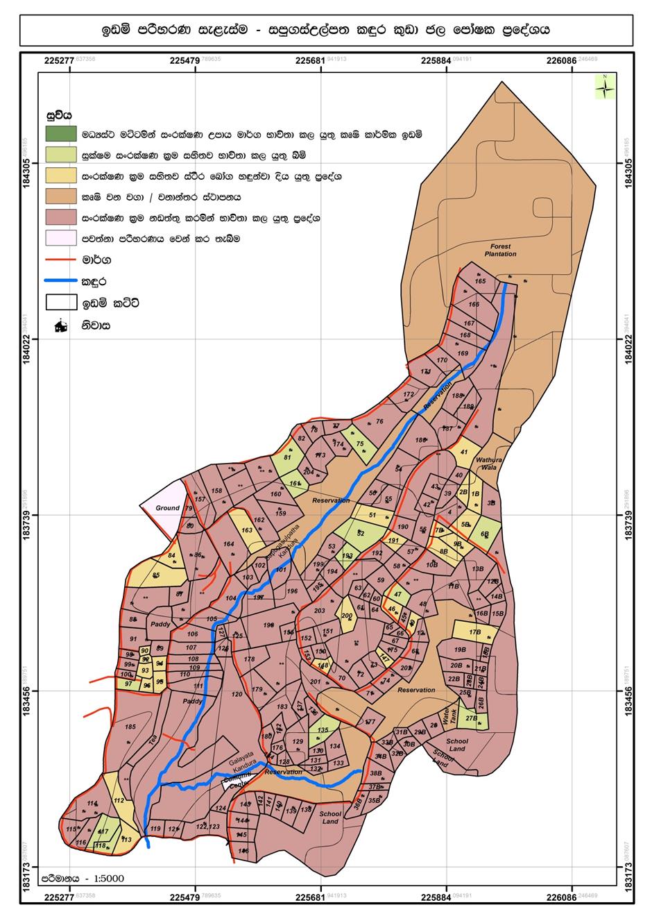
- Map: View Map
Description of the SLM Approach
Short description of the Approach
Microwatershed-based participatory land use planning is a systematic and interactive process that primarily focuses on the optimal allocation of village land resources according to needs and demands of the people while promoting sustainable land management. Key features of this approach are multi-sectoral coordination, multi-stakeholder engagement and the active participation of land users throughout the participatory land use planning process.
Detailed description of the Approach
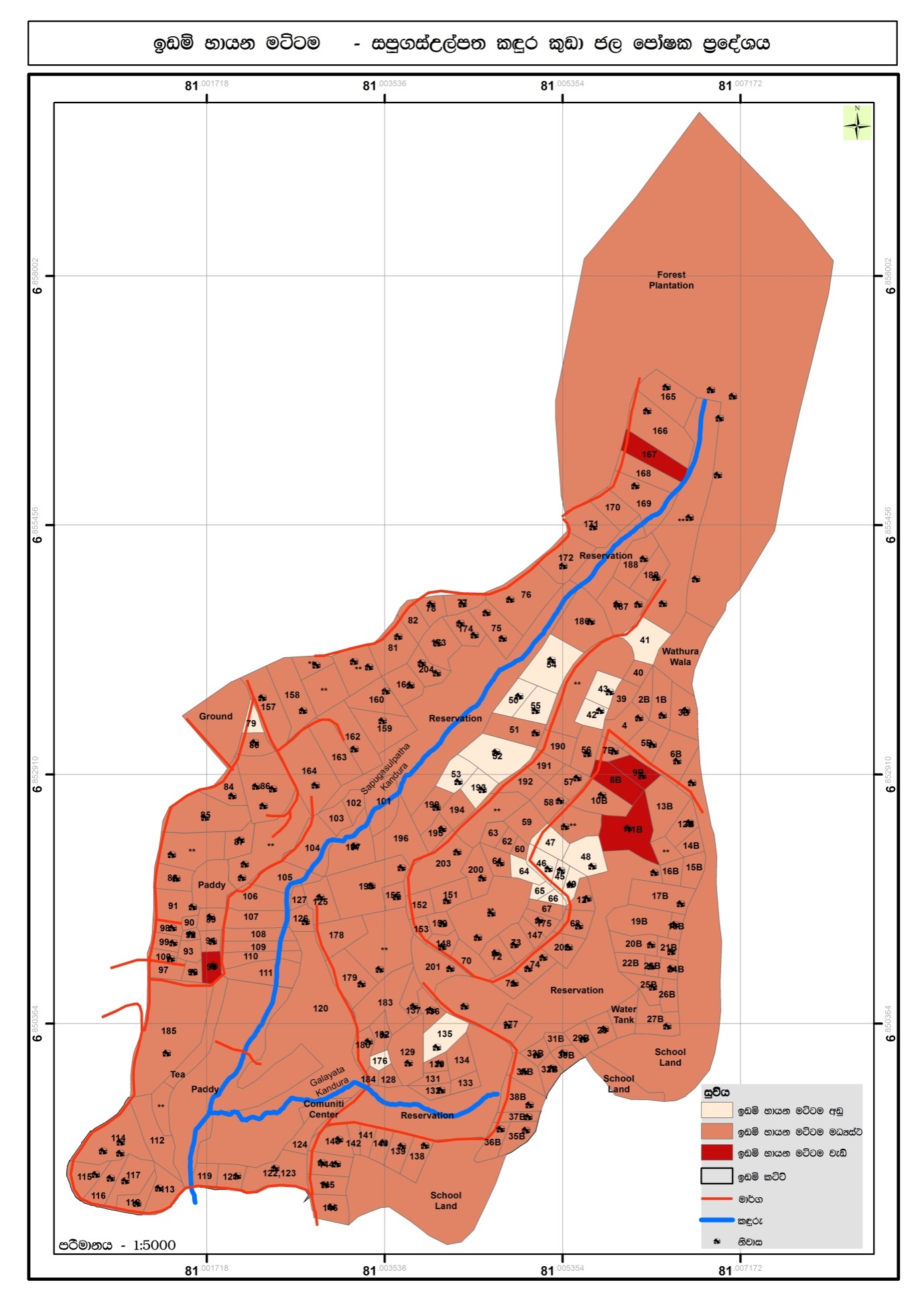
The Sapugasulpatha/ Galayata Kandura microwatershed is located in Bandarawela Divisional Secretariat (DS), Badulla District, Sri Lanka. Unsustainable land management has led to land degradation causing associated challenges. There was a need to identify strategies for restoration of degraded lands while addressing water scarcity. In 2018, the Rehabilitation of Degraded Agricultural Lands Project (RDALP) introduced participatory land use planning (PLUP) for this microwatershed. Previously, stakeholders were dealt with individually. But the PLUP process relies on the active involvement of all stakeholders. Key is microcatchment level planning - embedded in multi-sectoral coordination and multi-stakeholder engagement.
The process is initiated by the district office of the Land Use Policy Planning Department (LUPPD). Firstly, the LUPPD identifies microwatersheds and develops land use/cover maps. It is assisted by the Bandarawela DS, which is the administrative body for lands in the area and has the capacity to coordinate all relevant stakeholders. Then, officers of the LUPPD meet with community leaders, representatives of farmer organizations and field level officers to verify the land use maps through field visits. Demarcation of individual plots on these maps is also carried out. Next, a field visit is conducted with all stakeholders to identify the status of land degradation and the current crop management practices. This is, effectively, “training of trainers”. Subsequently, the community prepares maps of land degradation and management types with the support of LUPPD.
This is followed by a participatory rural appraisal (PRA) process with all stakeholders. In the PRA, issues related to land degradation/use, ownership, conflicts and socio-economic concerns are discussed. Participants come to an initial consensus on solutions. After this, a detailed action plan is prepared and stakeholders identified. The next stage involves the development of land use plans for the entire microwatershed targeting the restoration of degraded and poorly managed lands. The land use plan covers both on-farm and off-farm land, and provides recommendations for SLM practices over the entire microwatershed: it serves as a detailed land restoration plan. Then, detailed discussions are held with specific stakeholders to prepare sector-based plans. This includes detailed plans for individual farms. As an example, officers of Tea Smallholdings Development Authority (TSHDA) provide inputs to develop detailed plans for smallholder tea cultivation - including plans for individual farmers. Subsequently, implementation is performed jointly by stakeholders. If, for example, a farm is identified for tea cultivation intercropped with export crops, officers both from TSHDA and the Department of Export Agriculture extend their support. The approach includes farmer field schools (FFS) conducted by the Department of Agrarian Development officers and project officers of RDALP. Moreover, farmers are encouraged to use social media (WhatsApp®) to share their knowledge and experiences with SLM practices. The local community is also exposed to examples of good SLM through field visits. The final step is evaluation and monitoring. This is performed by the officers of the Agrarian Service Development, RDALP, and also by individuals. A divisional agricultural committee is mandated to perform continuous monitoring of implementation. PLUP provides the stimulus for farmers to continue SLM - since practices are not enforced but identified themselves. Further, firm bonding is established between land users and other stakeholders, including government institutes, strengthening the likelihood of sustainability.
Photos of the Approach
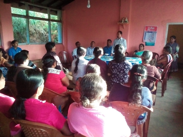
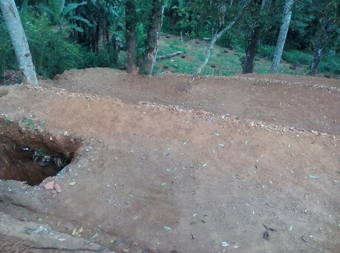
- 📍 Sapugasulpatha, Galayata Kandura
- 🗓 2018-08-01
- 📷 Mr. Upul Jayaweera
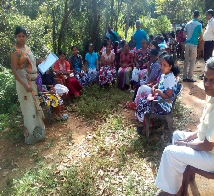
- 📍 Sapugasulpatha, Galayata Kandura
- 🗓 2018-10-01
- 📷 Mr. Upul Jayaweera
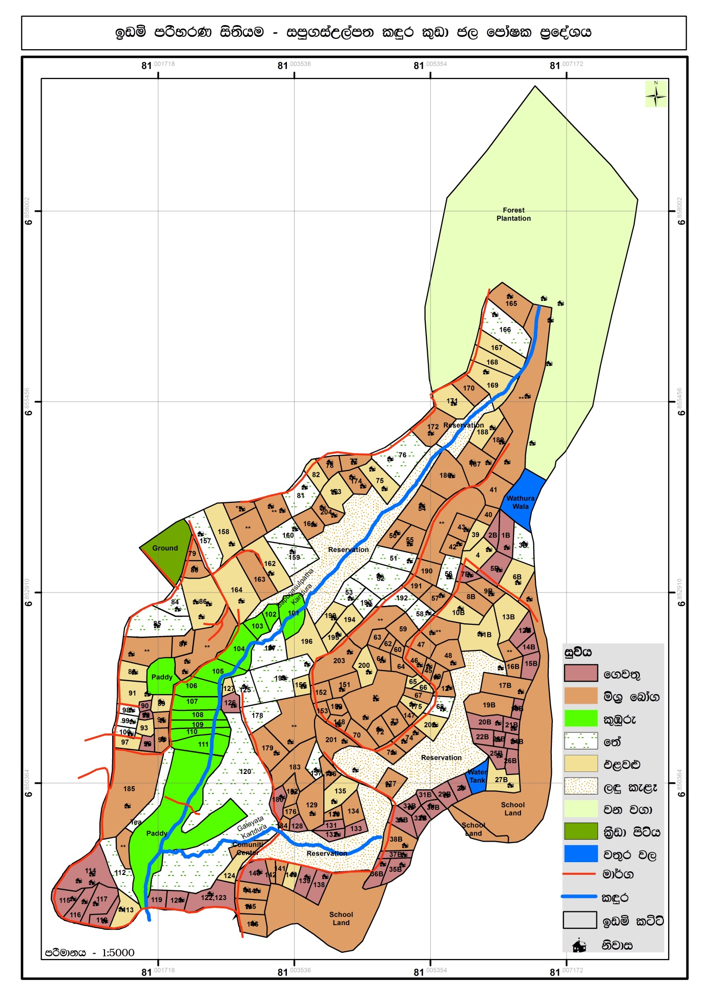
- 📷 LUPPD
- 📷 LUPPD
- 📷 LUPPD
- 📍 Sapugasulpatha, Galayata Kandura
- 🗓 2018-08-08
- 📷 Mr. Upul Jayaweera