
Early Warning Message Dissemination
Type: Approaches
Creation: 2016-10-20 13:24 Updated: 2017-10-30 16:21
Compilers: TUHIN SAMADDAR
Reviewers: Alexandra Gavilano, Alvin Chandra
Country/ region/ locations where the Approach has been applied
- Country: Bangladesh
- Region/ State/ Province: North-Bengal
- Further specification of location (e.g. municipality, town, etc.), if relevant: Kamarjani and Mollar Char union in Sadar Upazila and Haldia union in Shaghata Upazila of Gaibandha District
- Map: View Map
Description of the SLM Approach
Short description of the Approach
An effective system for dissemination of early warning messages was established among the vulnerable communities in Chars (riverine sandy islands) of Gaibandha district, Bangladesh, in order to strengthen their coping mechanisms and reduce loss and damage caused by floods.
Detailed description of the Approach
Early warning systems are an essential element in building resilience through effective disaster preparedness and risk mitigation: the key characteristics of the approach entail linking the intervention units at community level with national and sub-national early warning systems. It also consists of developing the capacity of the local government institutions and organised communities to not only disseminate early warning but to effectively respond to floods. Merely installing an early warning system is not sufficient to equip communities to cope with recurrent floods; it needs to be linked to broader aspects of disaster preparedness and increased response capacity of communities and local government.
The vulnerability and capacity assessment (VCA) is the basis of all measures oriented at reducing disaster risks. The VCA was carried out with the involvement of local stakeholders, especially the target communities, to understand the vulnerabilities and risks associated with floods as well as to gain insight on existing capacities and capacity gaps that needed to be addressed. The process resulted in a risk reduction action plan which was to be jointly implemented by the target community and local government.
The risk reduction plan pointed to the need of having in place a mix of structural, management and contingency measures. This involved linking local, sub-national and national early warning systems, developing contingency and evacuation plans supported by establishment of safe places where people could move during floods. The risk reduction plan also highlighted the need to support household level protection measures - structurally this meant raising household plinth levels above flood levels. In addition, local early warning system was established through installation of flood markers/pillars, and warning flags at key sites. Capacities were built to internalise, monitor and consequently respond to evolving local flood situation.
Building communication channels that link the local institutions to higher level flood forecasting system resulted in streamlining information from source to destination. The weather forecast communication flow is both vertical and lateral – vertically it is a mix of web-based flood information and mobile telephony which begins at the Flood Forecast Warning Centre (FFWC) - the apex body that monitors flood situation in Bangladesh. FFWC transmits information to the sub-national local governments that have digital centres with trained personnel to access information from FFWC website. Trained entrepreneurs at these digital centres are responsible for monitoring flood forecasts and updating the Union Parishad (the lowest level of local body) and communities on evolving flood situation. By analysing and interpreting relevant information they play a key role in catalysing the early warning system. The local bodies , Union Parishads, use a mix of communication modes - such as miking (public address system), radio and cellular phone - to transfer early warning information to the communities. On the other hand, flood markers are installed locally that are adjusted according to increase in water levels. Designated trained persons – Youth Response Team - take the responsibility to do this. This is monitored by community and the Union Parishad.
In normal times, drills and simulations are conducted by trained team of village volunteers/first responders. They take the lead in organising evacuation and movement to safe places. The government (and project) brings in the logistic support, especially transportation, to facilitate evacuation and movement to safe places.
Photos of the Approach
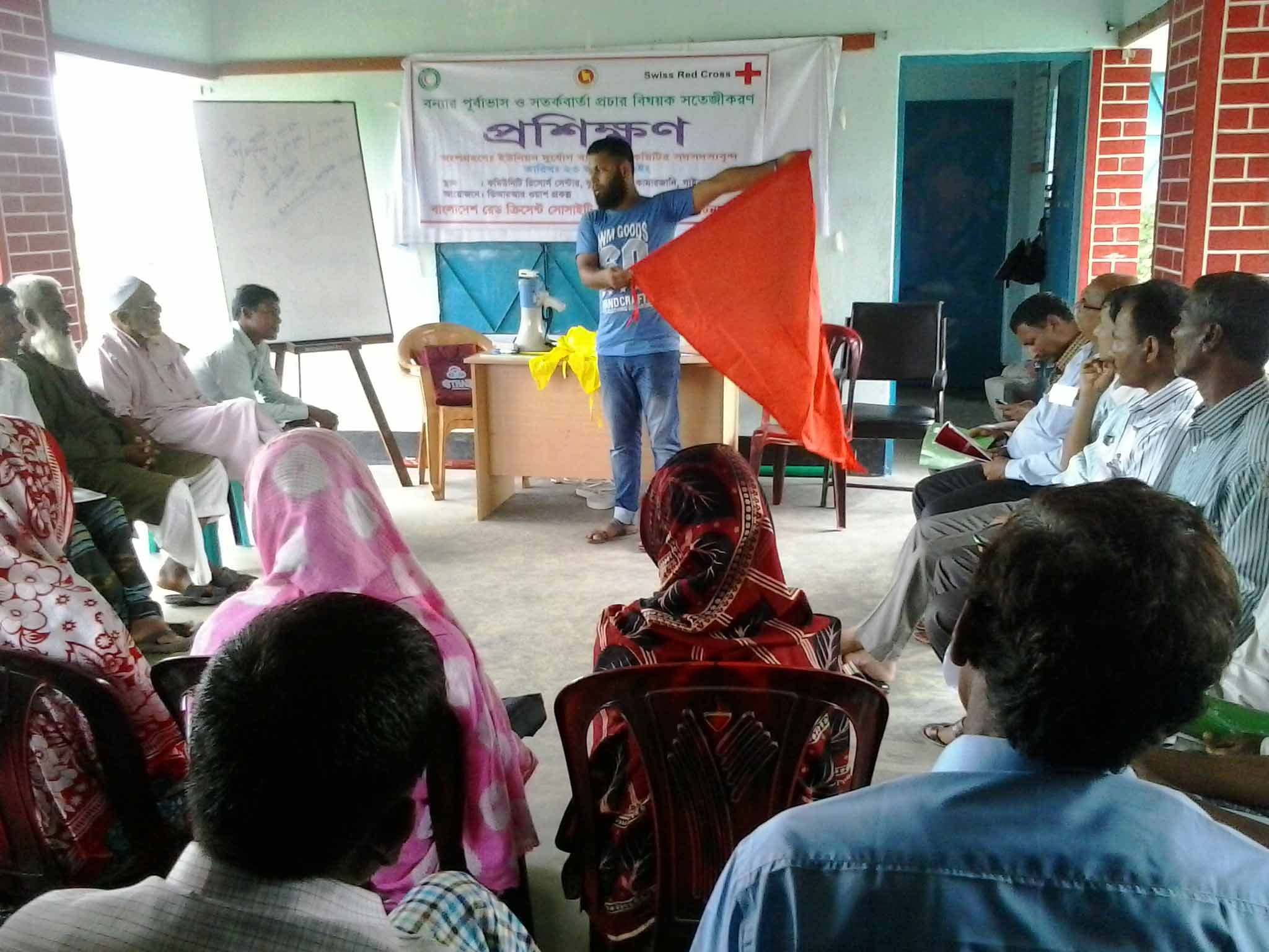
- 📍 Community Resource Center (CRC), Kundarpara village, Kamarjani union, Gaibandha
- 📷 Saiful Islam
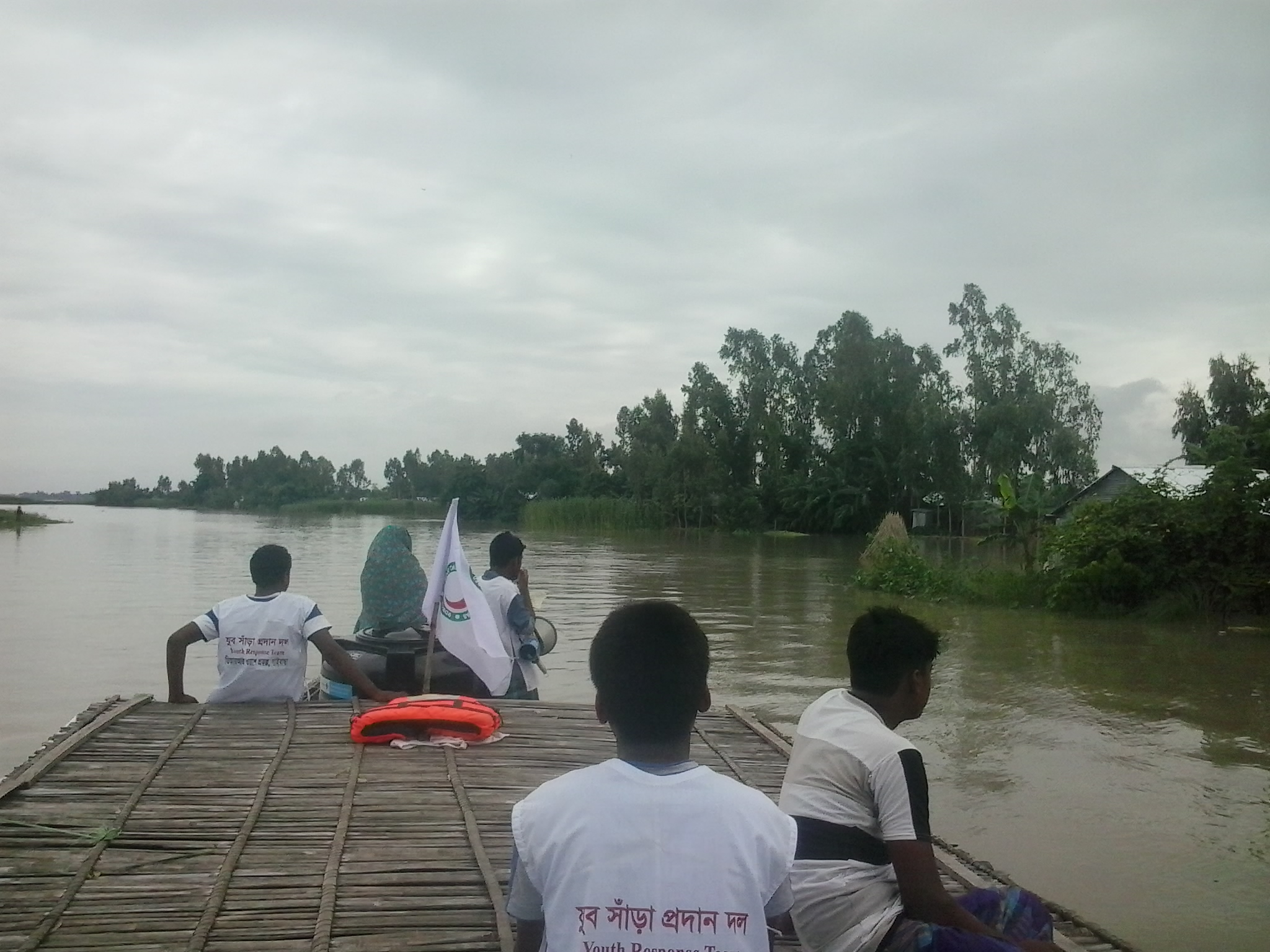
- 📍 Somewhere on Jamuna river, Dakkhin Dighalkandi village, Haldia union, Shaghata upazila, Gaibandha district
- 📷 Tuhin Samaddar
- 📍 Gaibandha
- 📷 Tuhin Samaddar