
E-Prakriti - An Approach Towards GIS Based Planning For Natural Farming
Type: Approaches
Creation: 2023-04-14 19:22 Updated: 2024-04-19 15:26
Compilers: Santosh Gupta
Reviewers: Rima Mekdaschi Studer, Udo Höggel, Joana Eichenberger, Sally Bunning
Country/ region/ locations where the Approach has been applied
- Country: India
- Region/ State/ Province: Madhya Pradesh
- Further specification of location (e.g. municipality, town, etc.), if relevant: Changariya village, Bichiya block,
- Map: View Map
Description of the SLM Approach
Short description of the Approach
The e-Prakriti approach is a GIS-based planning approach that integrates natural farming interventions for effective management, monitoring, and conservation of natural resources at the landscape level. It can be applied for projects such as soil and water management, land reclamation, crop and seed systems design and agri-infrastructure mapping. To establish and maintain an e-Prakriti system, it is necessary to collect and manage data effectively, to build capacity among stakeholders, to have the appropriate technology infrastructure in place and to promote the engagement of local communities with conservation organizations.
Detailed description of the Approach
The e-Prakriti approach is a planning method that utilizes GIS tools to integrate ecosystem-based natural farming interventions into agricultural operations. It focuses on creating scientific and efficient planning techniques that consider the landscape as a unit, such as a Village, Block, District and watersheds or river basins. This approach uses open-source datasets, including spatial and non-spatial data, to develop a comprehensive activity plan for natural resource management at a landscape level and having natural farming approaches as its core.
To facilitate the planning process using the various open-source platforms, GIZ has developed a comprehensive guide cum training module under the Pro-Soil Project. This guide comprehensively captures the different open-source platforms and their application to the local context, so to plan and implement natural-farming based interventions. The guide can be used to build the capacity of local-community resource persons, members of local self-governance (Panchayati Raj) institutions and other projects working at the village or cluster level.
The primary purpose of e-Prakriti is to enable effective and efficient management, monitoring, and conservation of natural resources, including sustainable soil management, water management, degraded land reclamation, crop and seed system design, bio-resource and fodder assessment, agro-infrastructure mapping, and the planning of sustainable enterprises. This e-Prakriti approach is used to conduct inventory and management of natural resources, such as forests, wetlands, and wildlife habitats, by mapping the extent and distribution of these resources and tracking their use and status over time. The e-Prakriti approach monitors changes in natural resources, evaluates the effectiveness of conservation measures, and identifies areas that require further intervention. Additionally, e-Prakriti technology can support planning and decision-making related to natural resource management by identifying areas most suitable for conservation or development activities.
Establishing and maintaining an e-Prakriti approach requires data collection on natural resources, effective data management, building capacity among stakeholders, appropriate technology infrastructure and institutional support. The benefits and impacts of the e-Prakriti approach include promoting sustainable development, improving natural resource management, reducing disaster risks, increasing community participation, improving policy and decision-making and conserving biodiversity. Land users' perceptions and experiences of e-Prakriti may vary depending on factors such as socio-economic background, level of education, cultural values and their relationship with natural resources. It is important to consider these factors when designing and implementing e-Prakriti approaches to meet the needs and expectations of land users.
GIZ has collaborated with the State Rural Livelihood Mission of Madhya Pradesh (MP-SRLM) for the practical application of the e-Prakriti approach in the planning process by the local community resource persons. GIZ provides training and operational support to team members for the successful application of e-Prakriti approaches in day-to-day work.
Photos of the Approach

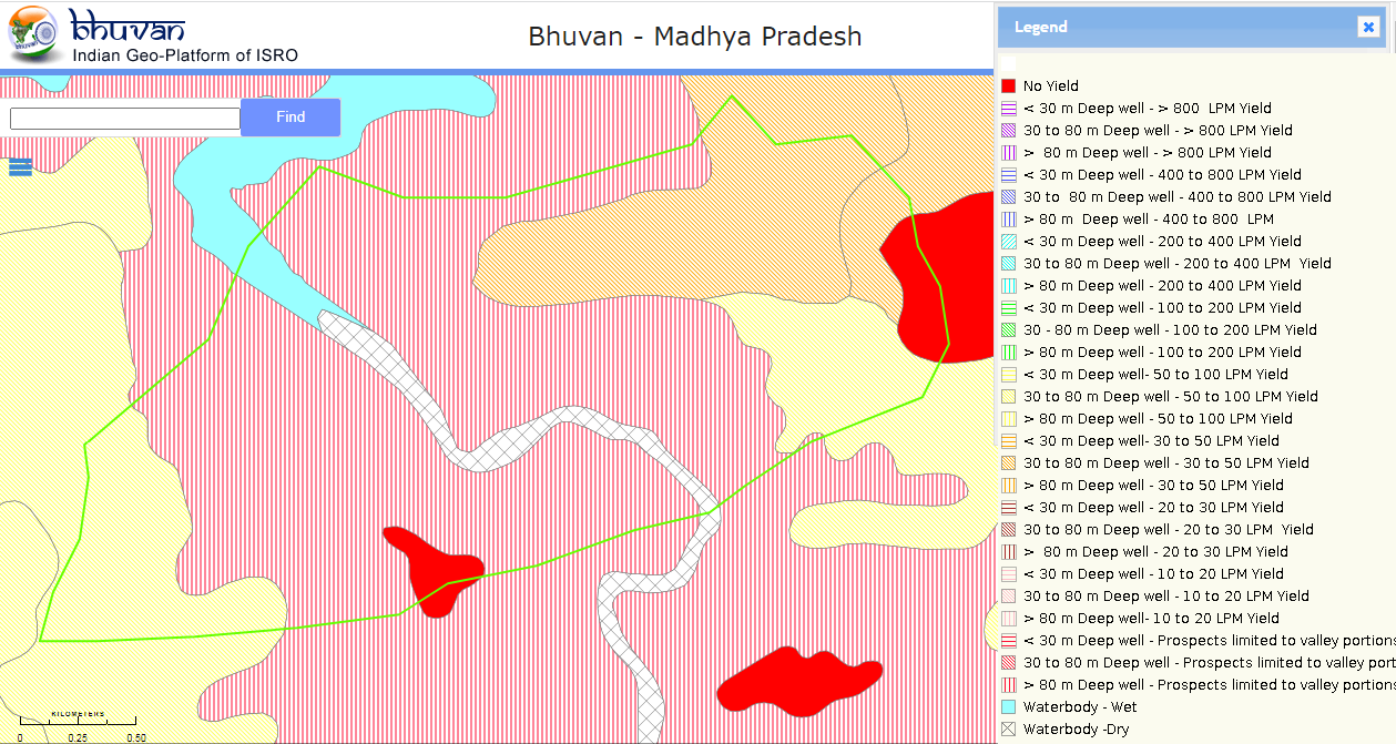
- 📍 Changariya village, Bichiya block, Mandla District, Madhya Pradesh
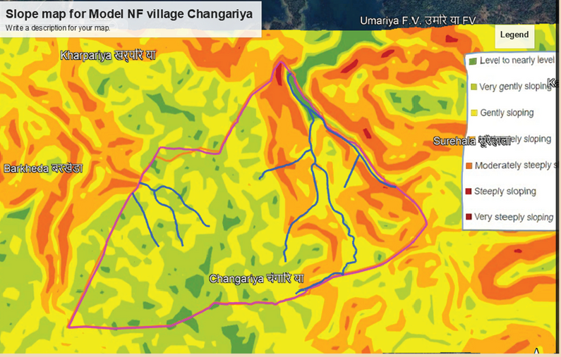
- 📍 Changariya village, Bichiya Block, Mandla District, Madhya Pradesh
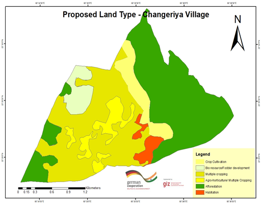
- 📍 Changariya village, Bichiya Block, Mandla District, Madhya Pradesh
- 📍 Changariya village, Bichiya block, Mandla district, Madhya Pradesh