
Participatory Understanding of Groundwater Dynamics: Threats and Responsive Management
Type: Approaches
Creation: 2025-05-26 11:23 Updated: 2025-06-17 09:33
Compilers: Pratik Ramteke
Reviewers: Rima Mekdaschi Studer, William Critchley
Country/ region/ locations where the Approach has been applied
- Country: India
- Region/ State/ Province: Maharashtra
- Further specification of location (e.g. municipality, town, etc.), if relevant: Darewadi,Post. Kauthe Malkapur Tal. Sangamner, Dist. Ahilyanagar, Maharashtra
- Map: View Map
Description of the SLM Approach
Short description of the Approach
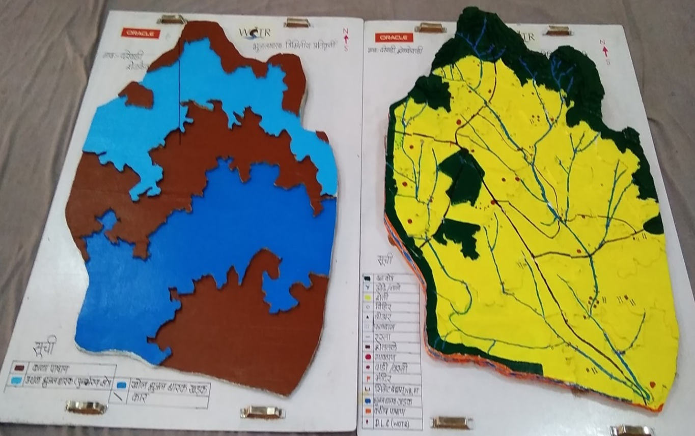
CoDriVE-VI is a participatory approach that integrates local knowledge with scientific data through 3D visual modelling to assess groundwater vulnerability and support sustainable, community-based groundwater management. It overlays surface and subsurface features, enabling villagers to visualize aquifer systems and develop informed water use plans.
Detailed description of the Approach
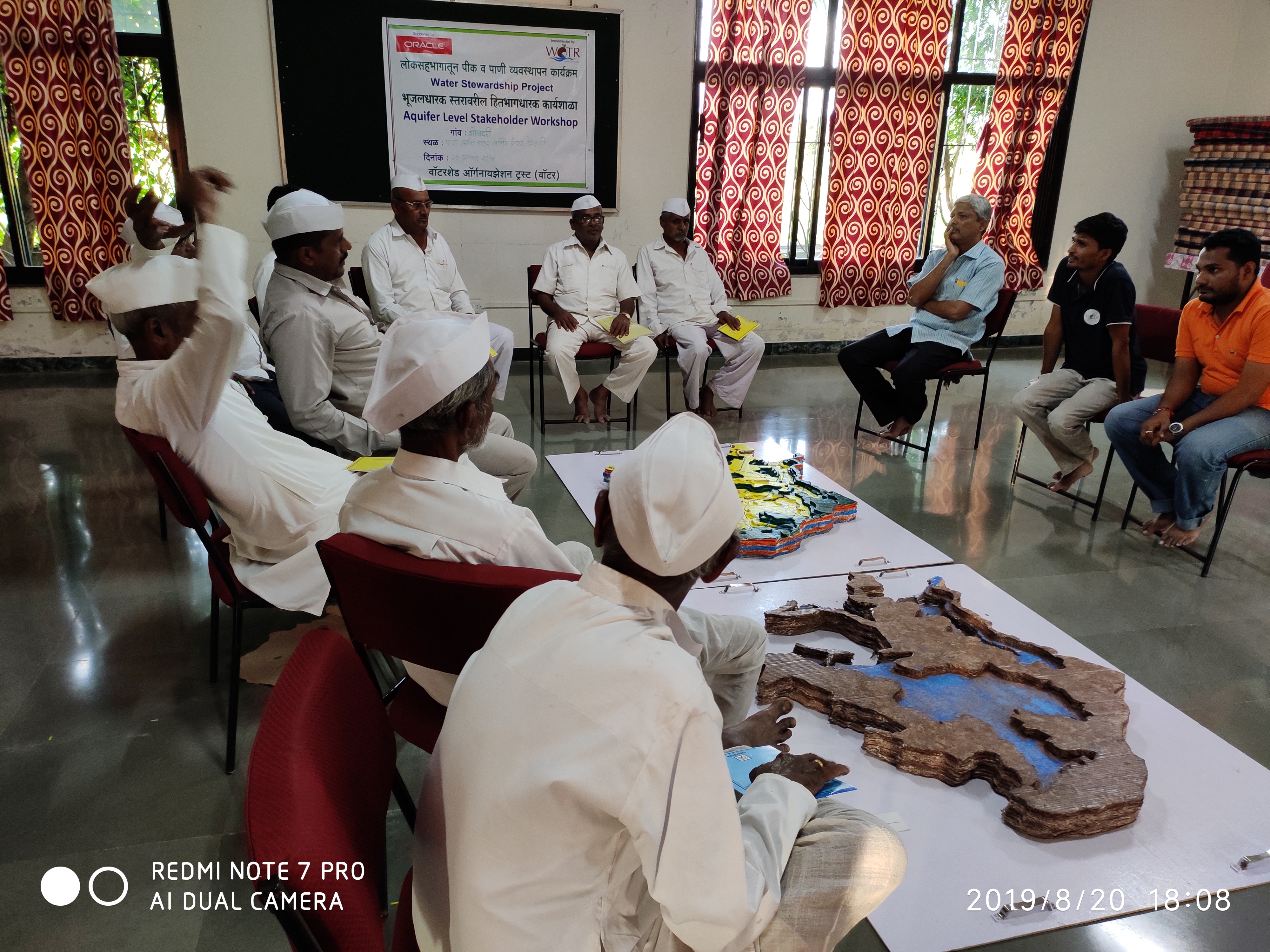
CoDriVE-VI (Community-driven Vulnerability Evaluation – Visual Integrator) is a participatory approach developed by the Watershed Organisation Trust (WOTR) to support sustainable groundwater management. It aims to demystify the invisible subsurface and make aquifer systems understandable to rural communities by combining scientific tools with local knowledge in a hands-on, visual format. While the process is facilitated by WOTR, communities are placed at the center of the process, contributing traditional insights, assisting with data collection, and actively participating in constructing and interpreting the 3D model. Thus, the approach is best described as participatory, with strong elements of community ownership and engagement.
The “Visual Integrator” refers to the integration of both surface and subsurface data—such as topography, drainage, geology, well inventory details, and geophysical survey results—into a tangible, scaled three-dimensional model. This participatory 3D modelling (P3DM) process helps communities visualize how aquifers relate to the landscape, showing key features such as recharge zones, discharge points, and areas of intensive groundwater extraction.
“Vulnerability evaluation” is carried out through the community’s participatory analysis of the model. Using the integrated visual platform, villagers can identify zones that are more vulnerable to depletion—such as those with low recharge, high borewell density, or historically declining water tables. While a formal vulnerability matrix is not used, the 3D model serves as a practical vulnerability map. It guides discussions and decisions around water budgeting, aquifer recharge, crop-water planning, and the development of informal rules for responsible groundwater use.
The methodology combines participatory rural appraisal with hydrogeological and geospatial techniques. After an initial orientation and trust-building phase, communities help map surface features. Subsurface data is then collected through geological mapping, well inventory surveys, and geophysical methods like Vertical Electrical Sounding (VES). The data are analyzed using GIS tools and inverse slope modelling. The 3D model is then constructed using layered cardboard sheets, with communities contributing throughout the process—cutting, assembling, painting, and validating the layers.
The CoDriVE-VI process unfolds in several stages: community mobilization and planning; surface and subsurface data collection; model building in participatory workshops; and result interpretation and management planning. Key stakeholders include community members, WOTR facilitators, technical experts (geologists and GIS specialists), and local governance representatives.
Participants found the visual models highly effective in helping them grasp aquifer dynamics, leading to a shift in perception—from seeing groundwater as an individual entitlement to recognizing it as a shared resource. This in turn fostered collective decision-making. The approach has also contributed to improved groundwater literacy, informed water budgeting, and motivated some villages to initiate local groundwater governance practices.
While climate change is a key driver of groundwater stress, the approach also acknowledges other socio-economic and environmental pressures—such as population growth, land-use change, deforestation, and the uncontrolled proliferation of borewells—as critical factors influencing groundwater vulnerability. By visualizing these interconnections, CoDriVE-VI supports more holistic and sustainable groundwater management at the community level.
Photos of the Approach
- 📍 Darewadi,Post. Kauthe Malkapur, Tal Sangamner, Dist. Ahilyanagar, Maharashtra
- 📷 Navnath Ghodake
- 📍 Darewadi,Post. Kauthe Malkapur Tal. Sangamner, Dist. Ahilyanagar, Maharashtra
- 📷 Ankita Yadav