
Municipal Pastureland Planning
Type: Approaches
Creation: 2025-06-29 18:33 Updated: 2025-12-15 11:59
Compilers: Nicholas Euan Sharpe
Reviewers: William Critchley, Joana Eichenberger
Country/ region/ locations where the Approach has been applied
- Country: Georgia
- Region/ State/ Province: The Georgian Municipalities of Dmanisi, Gurjaani and Kazbegi
- Map: View Map
Description of the SLM Approach
Short description of the Approach
The Municipal Pastureland Planning approach was developed collaboratively with key national and local stakeholders to establish a structured, evidence-based decision support framework for sustainable rangeland governance. This system consolidates and presents data from diverse stakeholder groups in a format fully compatible with the Land Degradation Neutrality Framework, ensuring that planning aligns with both environmental and socio-economic objectives.
Detailed description of the Approach
The Municipal Pastureland Planning approach was developed through close collaboration with national and municipal stakeholders, and was designed to operate at two interrelated levels, as defined by the National Pastureland Management Policy Concept and forthcoming Law on Pasture Management, namely:
1. Upper tier planning - Participatory pasture planning at the municipal scale.
2. Lower tier implementation - Pasture management planning and SLM technology application at the level of individual pasture units (which was piloted in villages and is the subject of the WOCAT database entry on the “Controlled Grazing” technology).
To achieve these goals and provide a practical model for other municipalities and national policy, the Municipal Pastureland Planning approach piloted included the following components:
a) spatial distribution of pastures according to ownership forms and use regimes (identification of common use pastures and pastures for leasing);
b) identification of pasture users and number of livestock according to administrative units and municipal census;
c) Assessment of current practices of livestock farming and pasture use;
d) Analyses of the results of pasture monitoring or pastures multi-factor assessments including land degradation rates (see the WOCAT database entry on the Participatory Rangeland and Grassland Assessment - PRAGA);
e) Identification and stakeholder consensus of priority pastures for restoration and measures for their restoration;
f) Assessment of optimal pasture carrying capacity and actual stocking rates;
g) Investments needed in pasture infrastructure development;
h) Implementation plan and estimated budget; and
j) Monitoring programme for the implementation of the plan and corrective measures.
Municipal Pastureland Planning functions as a stepwise instruction manual for carrying out these components in accordance with the Land Degradation Neutrality (LDN) conceptual framework. The process can require access to cadastral and land tenure data, often requiring coordination and approval from local and state authorities to ensure access and consistency across datasets.
The participatory stakeholder approach has brought to light common themes across the three pilot municipalities:
•The critical need to formalize access rights and clarify pasture tenure;
•Challenges related to low organizational capacity among pasture users;
•The importance of community engagement for identifying investment priorities and restoration areas; and
•The necessity of linking local-level decisions to national LDN targets and broader agricultural strategies.
Ultimately, Municipal Pastureland Planning provides Georgia with a replicable framework for achieving LDN at multiple governance levels. By combining spatial data analysis, stakeholder participation, and evidence-based planning, it strengthens municipal capacity, supports sustainable land use, and contributes directly to the national LDN targets — particularly Target #1 (mainstreaming LDN into policies and planning) and Target #4 (rehabilitation of degraded lands). The experience gained through the pilot municipalities demonstrates that structured, participatory pasture planning can serve as a cornerstone for sustainable rural development and the long-term resilience of Georgia’s pastures and grazed ecosystems.
The approach was developed and tested under the GEF-funded project “Achieving Land Degradation Neutrality Targets of Georgia through Restoration and Sustainable Management of Degraded Pasturelands (GCP/GEO/006/GFF)”, which piloted the participatory approach through the development of municipal-scale pasture plans for three Georgian municipalities.
Photos of the Approach
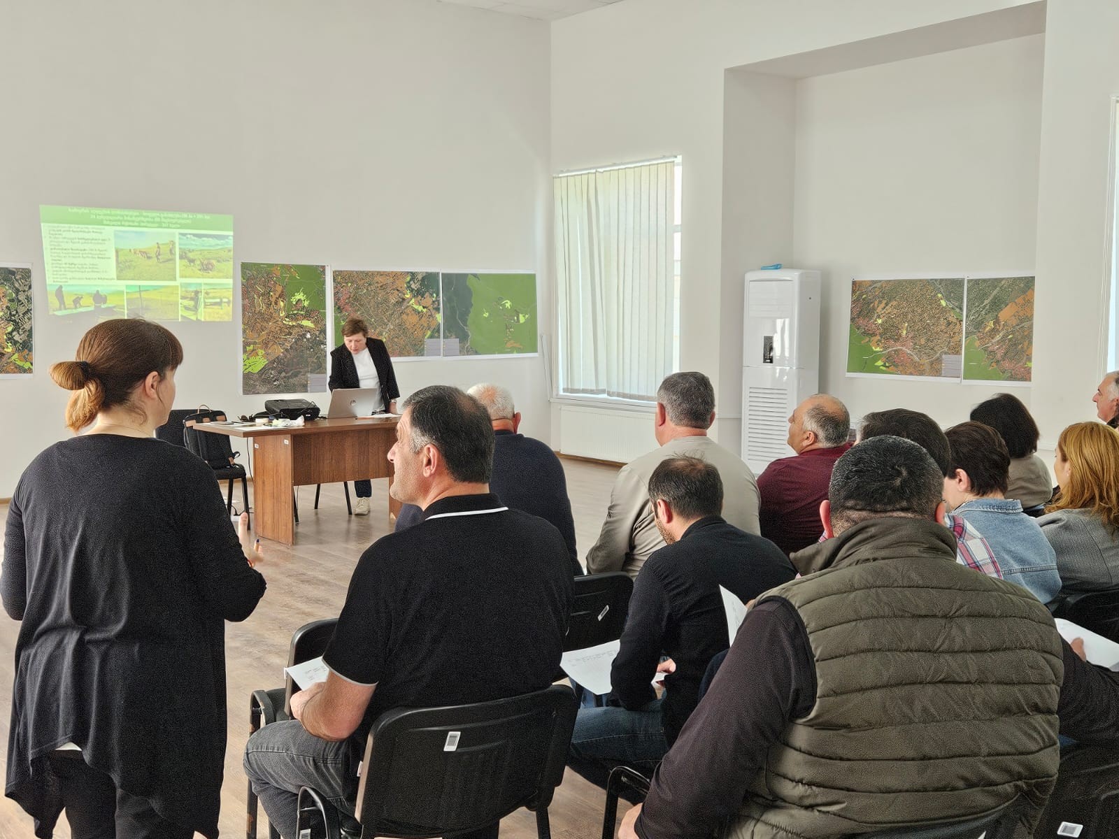
- 📍 Gurjanni, Georgia
- 📷 Regional Environmental Centre for the Caucasus (REC Caucasus)
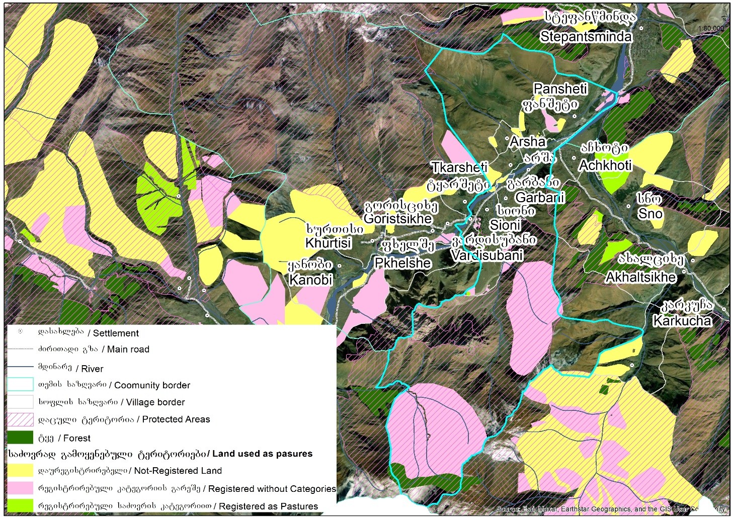
- 📍 Kazbegi, Georgia
- 📷 Regional Environmental Centre for the Caucasus (REC Caucasus)
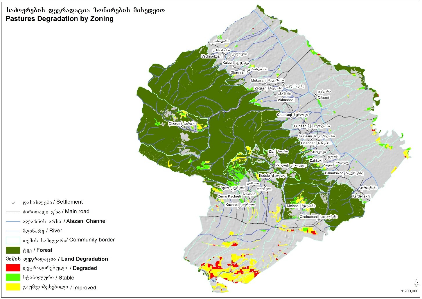
- 📍 Gurjaani, Georgia
- 📷 Regional Environmental Centre for the Caucasus (REC Caucasus)
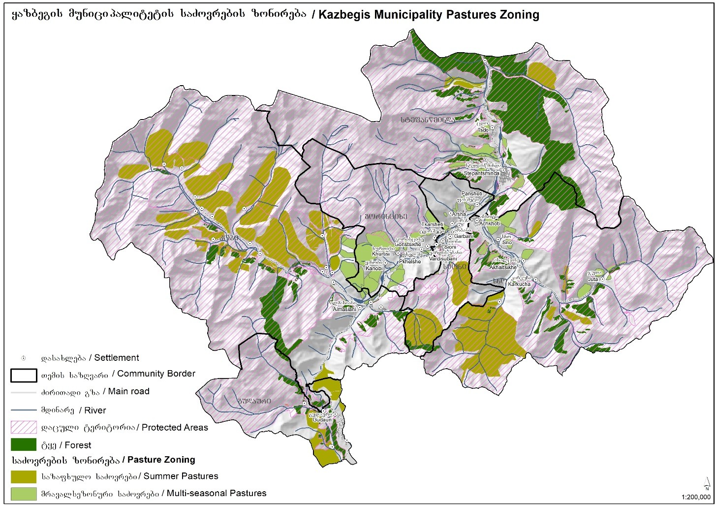
- 📍 Kazbegi, Georgia
- 📷 Regional Environmental Centre for the Caucasus (REC Caucasus)