
Participatory Net Planning for Sustainable Watershed Management
Type: Approaches
Creation: 2025-10-07 10:31 Updated: 2025-12-06 16:33
Compilers: Arun Bhagat
Reviewers: Udo Höggel
Country/ region/ locations where the Approach has been applied
- Country: India
- Region/ State/ Province: Maharashtra
- Further specification of location (e.g. municipality, town, etc.), if relevant: Darewadi,Post. Kauthe Malkapur, Taluka Sangamner, Dist. Ahilyanagar,
- Map: View Map
Description of the SLM Approach
Short description of the Approach
Participatory Net Planning (PNP) is a practical methodology that actively engages landowners and local stakeholders in planning and implementing measures for land use, soil conservation, water harvesting, and biomass development. It aims to regenerate ecosystems and improve the sustainability of watersheds through site-specific resource management. PNP emphasizes the conservation, productivity enhancement, and sustainable use of natural and biological resources. It involves assessing the current condition and use of land, water, and vegetation, and preparing detailed plans—with estimated costs and timelines—to achieve the desired outcomes.
In Participatory Net Planning (PNP), the term “Net” represents a complete and interconnected planning framework where every land parcel within a watershed is individually assessed and linked to the larger watershed system. It highlights a network-based approach that integrates soil, water, vegetation, and community needs, ensuring that interventions on one farm support resource conservation and productivity across neighboring and downstream lands. Overall, it signifies a holistic and coordinated system where all stakeholders and resources are planned collectively for sustainable and long-term watershed management.
Detailed description of the Approach
By design, PNP functions as a tool for mobilization, training, monitoring, and evaluation in watershed programs.
Its key objectives are:
•Building ownership and commitment among landowners and stakeholders to ensure the long-term sustainability of watershed interventions.
•Planning site-specific measures that meet local needs, improve productivity, and address resource challenges.
•Developing realistic plans with clear activities, budgets, and timelines that can be implemented effectively, minimizing gaps between planned and actual outcomes.
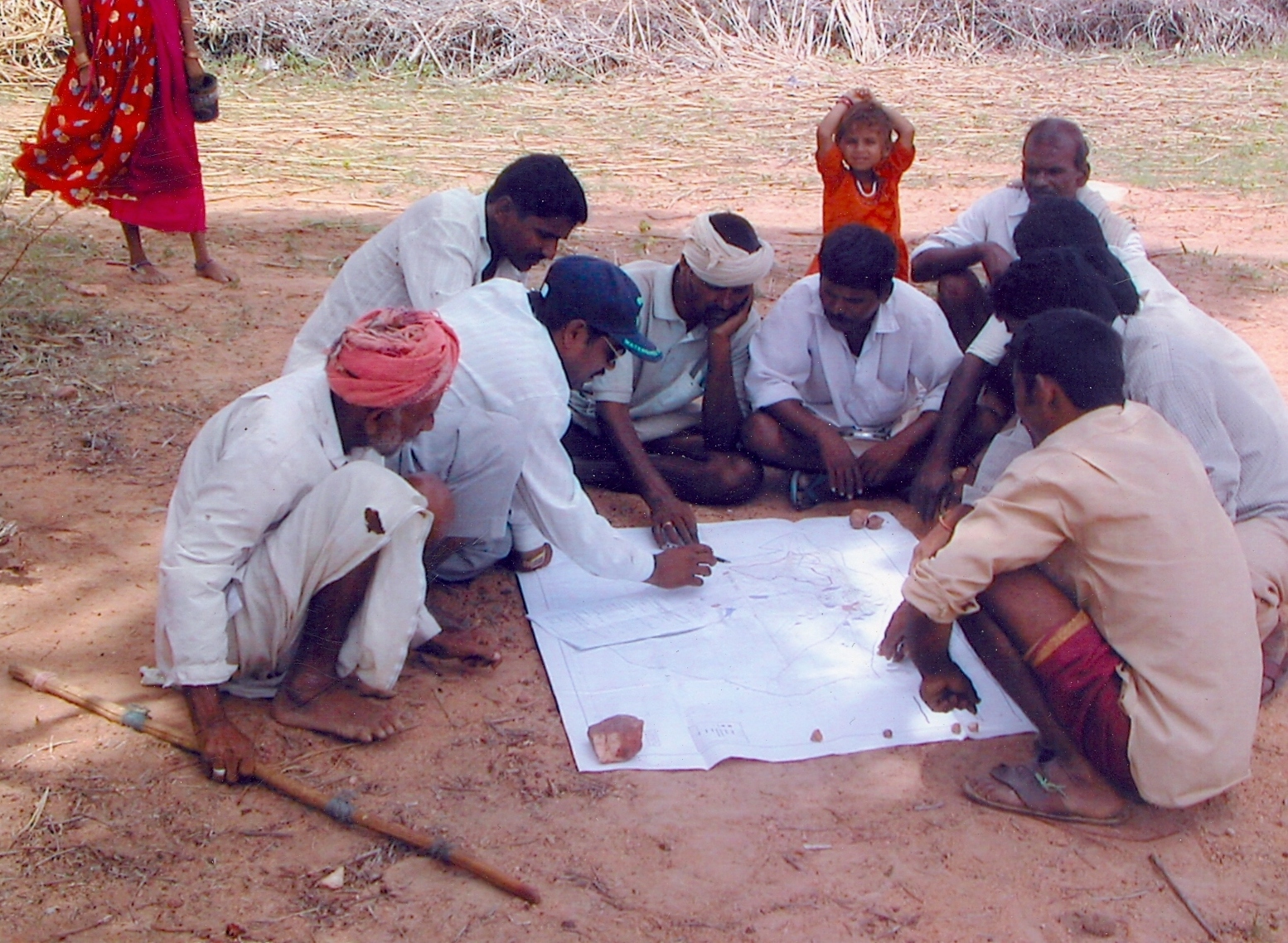
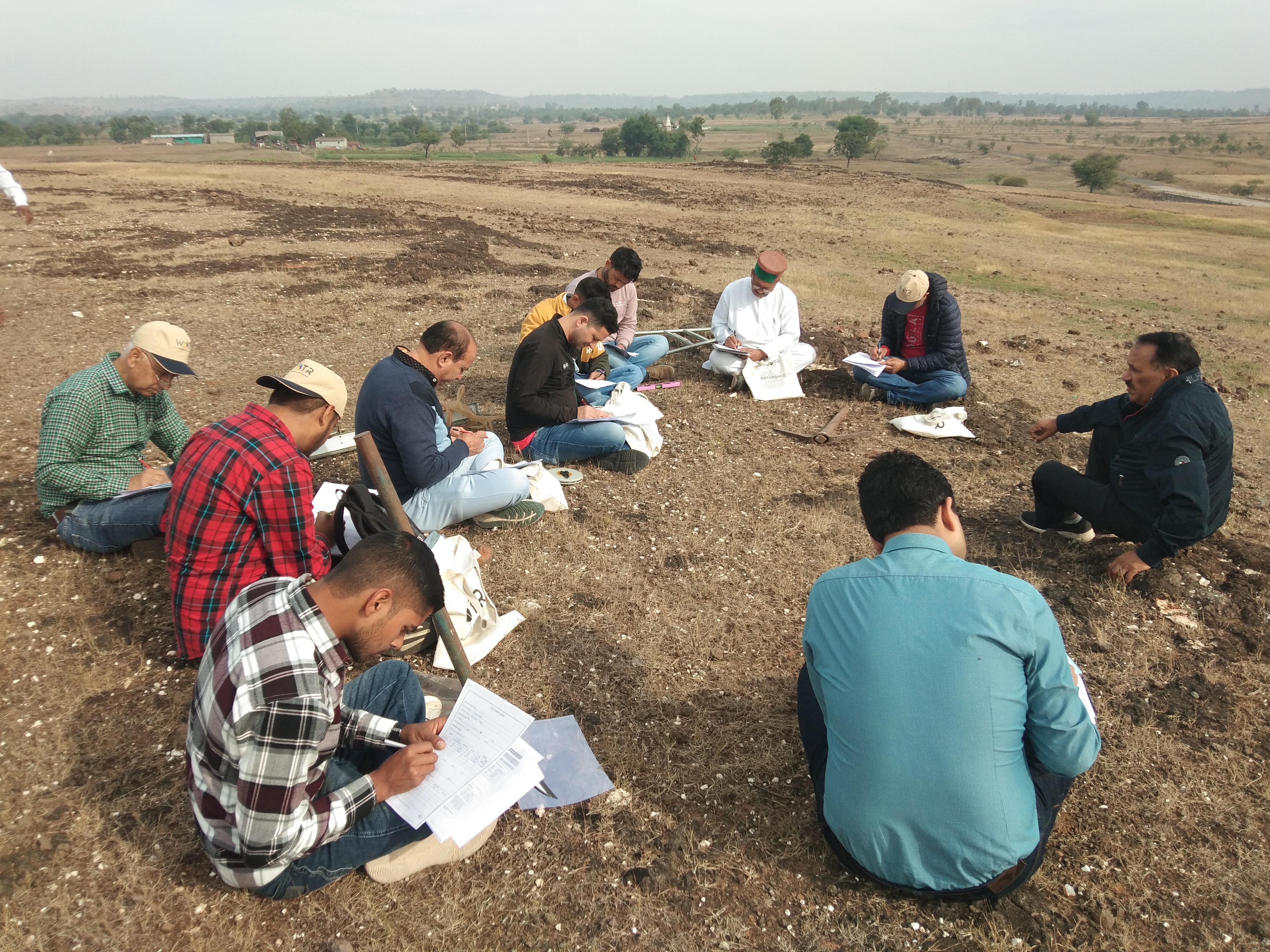
The PNP approach places stakeholders at the center of the process. Landowners, farmers (both men and women), or users of Common Property Resources (CPRs) are directly involved in decision-making for their land or shared resources. During PNP exercises, the planning team visits each landholding or CPR along with the concerned stakeholders to jointly survey, assess, and plan interventions.
Stakeholders share their views on current and proposed land use and the necessary soil and water conservation treatments. The team discusses best practices and scientific options for land management, explaining their benefits and suitability. The final decision on interventions rests with the stakeholder—except when proposed actions could harm neighboring lands, CPRs, or the environment. In such cases, efforts are made to reach a consensus; if not possible, treatments on that land are withheld.
Once agreement is reached, the proposed measures are documented in writing and mapped on a diagram of the land or CPR.
PNP is gender-inclusive, ensuring both men and women participate in planning and decision-making. Ideally, the farming couple or land-owning couple is present during planning, even when land is officially registered in the man’s name. For CPRs, where stakeholders include landless people, marginal farmers, livestock owners, and shepherd communities, institutions like the Village Watershed Committee (VWC), Village Development Committee (VDC), and Gram Panchayat (GP) are involved. Their role is to ensure equitable access to ressources, manage conflicts, and establish transparent and representative local institutions for sustainable management of CPRs and create assets.
The Participatory Net Plan is more than just a planning document—it serves as a blueprint for implementation. Written in the local language, it remains accessible to stakeholders for regular reference. The plan is flexible and adaptive, evolving as new information emerges or stakeholders revise their preferences. Thus, it acts as a “living document” that supports transparency, continuous monitoring, and accountability.
Photos of the Approach
- 📍 Darewadi, Post. Kauthe Malkapur Tal. Sangamner, Dist. Ahilyanagar, Maharashtra, Maharashtra, India
- 🗓 2024-11-09
- 📷 Prashant Kalaskar (WOTR)
- 📍 Darewadi, Post. Kauthe Malkapur Tal. Sangamner, Dist. Ahilyanagar, Maharashtra, Maharashtra, India
- 🗓 2024-09-10
- 📷 Amol Satpute (WOTR)