
Contour Farming using hedgerows
Type: Technologies
Creation: 2015-10-22 03:18 Updated: 2017-03-29 04:28
Compilers: Philippine Overview of Conservation Approaches and Technologies
Reviewers: Eduardo Alberto, Alexandra Gavilano
Country/ region/ locations where the Technology has been applied and which are covered by this assessment
- Country: Philippines
- Region/ State/ Province: La Libertad
- Further specification of location (e.g. municipality, town, etc.), if relevant: Negros Oriental
- Map: View Map
Description of the SLM Technology
Short description of the Technology
Contour farming is a technology practiced in sloping areas in which hedgerows are established along the contours and other annual/cash crops are grown in the alleys between the hedges.
Detailed description of the Technology
Contour farming is being practiced by the farmers in sloping areas to prevent or control soil erosion. Hedgerows are established along contour lines using napier grass and permanent crops like banana and coconut. In between contour lines, corn is inter-cropped with peanut. It is a traditional practice of farmers and one of the conservation techniques for the Conservation Farming Village Approach (CFV).
Purpose of the Technology: This is practiced by farmers to control surface run-off, erosion and to conserve natural soil fertility. Napier grass is also planted as source of feeds for the livestocks. The technology controls dispersed runoff, reduce slope angle and length.
Establishment / maintenance activities and inputs: Contour lines were established using an A-frame to determine the location of the hedgerows to be planted. Napier grasses are planted along the contour at 8x8m and 4X4m distance. Grafted cacao trees are also inserted in between banana at 4X4 distance. The alleys between hedges measuring 4m wide and 30m long are planted with corn and peanut. Napier grass is regularly trimmed to maintain a height of not more than a meter, using the cuttings as livestock fodder.
Natural / human environment: The area is under a humid climate condition with an average annual rainfall of 1000-1500 mm. Its elevation is 500-1000 m above mean sea level.The average cropland size of land users is less than or equal to 0. 5 hectare with a slope ranging from 18-25%. Income of land users are derived from the crops sold. The Local Government Unit (LGU) provides truck to transport the harvested crops of the farmers from the village to the town market twice a week.
Photos of the Technology
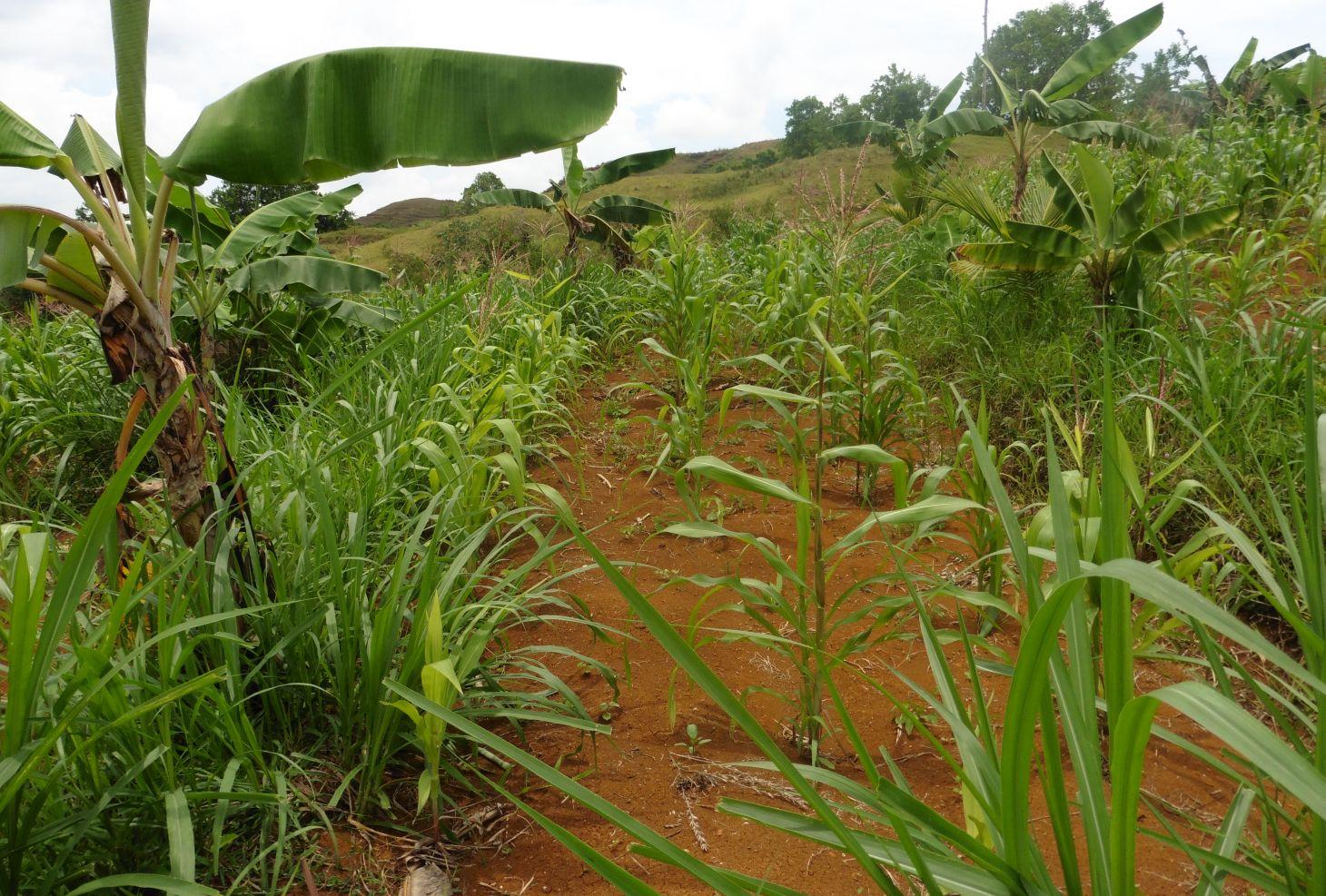
- 📍 Brgy. Talaon, La Libertad, Negros Oriental
- 📷 Engr. Djolly Ma. P. Dinamling (Bureau of Soils and Water Management)
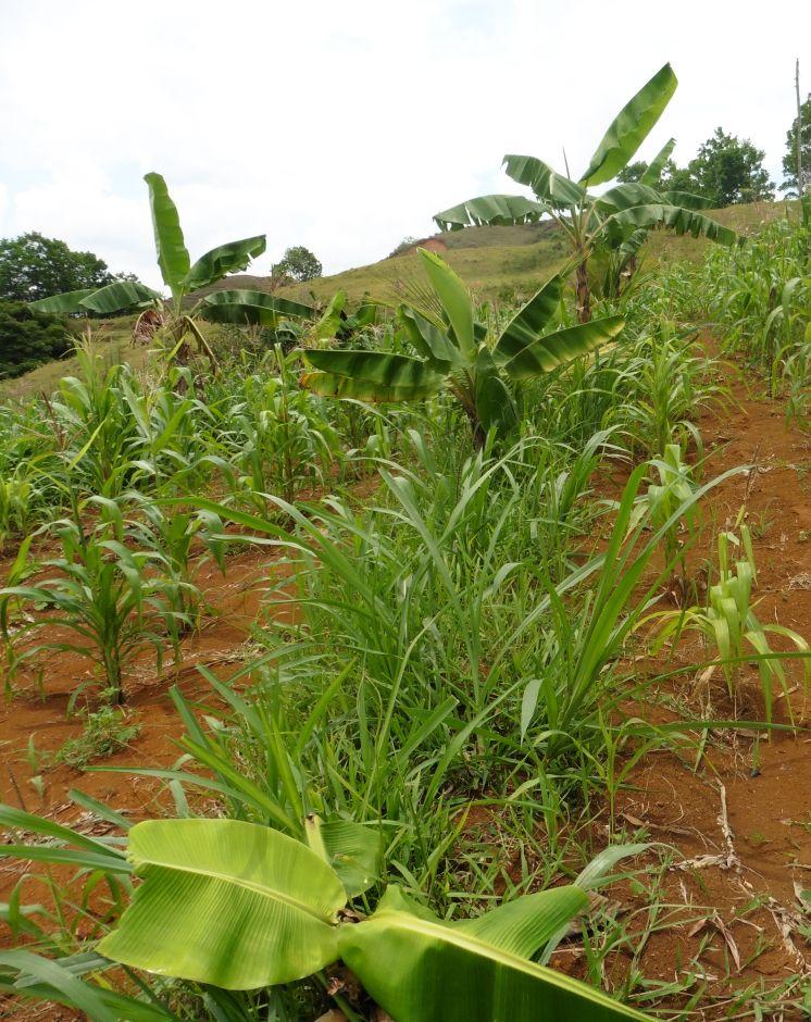
- 📍 La Libertad, Negros Oriental
- 📷 Engr. Djolly Ma. P. Dinamling