
Planting poplar forest in the flood plains of high mountain river areas
Type: Technologies
Creation: 2011-04-24 10:24 Updated: 2019-08-21 16:47
Compilers: Gulniso Nekushoeva
Reviewers: Alexandra Gavilano, David Streiff
Country/ region/ locations where the Technology has been applied and which are covered by this assessment
- Country: Tajikistan
- Region/ State/ Province: Tajikistan / GBAO
- Further specification of location (e.g. municipality, town, etc.), if relevant: Shugnan / Vankala
- Map: View Map
Description of the SLM Technology
Short description of the Technology
The afforestation of the low productivity sandy lands in the river valley areas of arid highlands with fast growing poplar trees, provides the population with firewood as well as timber and also provides conservation benefits.
Detailed description of the Technology
In the Jamoat Vankala area of the Shugnan district in GBAO, low temperatures make it very difficult to grow fruit or trees other than poplar (Populus pamirico) or Salix Schugnanica Coerz.
The natural forest consists mainly of the latter and this grows very slowly. It is very cold for 6-7 months of the year in this region, so the demand for cheap firewood to heat homes is extremely high.
In the 1980s, the sovhoz decided to transform 10ha of a low productivity pasture land into more productive irrigated forest land. After the collapse of the Soviet system, the Jamoat rented this forest land to a farmer, who still remains in charge of this piece of land.
Purpose of the Technology: The creation of a poplar forest on the river shore in this treeless desert alpine zone can go someway towards meeting the local's demand for firewood. It can provide cheap timber and environmental benefits as well as a pleasant environment.
Establishment / maintenance activities and inputs: The process of establishing this poplar forest began with the creation of irrigation canals and the planting of seedlings. In the first few years, the seedlings had to be watered frequently due to the thirsty sandy soils.
Other factors that needed to be considered were protecting the area from grazing cattle, watering areas around the forest away from the the river bank, the selective felling of some poplars, the additional planting of trees on barren soil, as well as the protection of the forest from predatory deforestation by the locals (which has increased during the economic crisis). Thanks to natural regeneration processes, farmers can now prepare firewood for the winter and do not have to bring the timber from far away.
Natural / human environment: 88% of the Pamir region is covered by glaciers, snow, and rocks, and is thus completely devoid of soil. Consequently, the area of arable and orchard lands in the GBAO region is only about 2%, with a forest area of 0.4%. Two-thirds of all the Pamir natural forests are located along the river banks of the Vanch, Gunt, Tokuzbulak, and others, at an altitude of 3200m.
In the narrow V-shaped valleys of the Western Pamirs, the lowest points are at an altitude of 1,200m,extending up to the highest points at 7,400m. This explains the climatic differences within the region, because the lower parts in the valleys enjoy a warmer climate than the higher parts. Overall, the annual average air temperature in the region is 9°C, and most rainfall occurs between the winter and spring periods with an average precipitation of 191-227mm.
Photos of the Technology
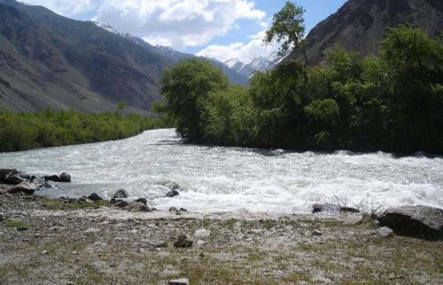
- 📍 Jamoat Vankala, v.Rohi Nav, Shugnan/GBAO/Tajikistan
- 🗓 2010-09-07
- 📷 Gulniso Nekushoeva (Tajikistan, Dushanbe)
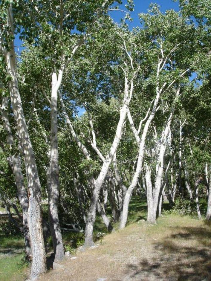
- 📍 Jamoat Vankala, v.Rohi Nav, Shugnan/GBAO/Tajikistan
- 🗓 2010-09-07
- 📷 Gulniso Nekushoeva (Tajikistan, Dushanbe)