
Pipe Irrigation
Type: Technologies
Creation: 2014-01-16 13:15 Updated: 2019-06-05 12:31
Compilers: Sabita Aryal
Reviewers: Fabian Ottiger, Alexandra Gavilano
Country/ region/ locations where the Technology has been applied and which are covered by this assessment
- Country: Nepal
- Region/ State/ Province: Chyamrangbesi
- Further specification of location (e.g. municipality, town, etc.), if relevant: Kavre
- Map: View Map
Description of the SLM Technology
Short description of the Technology
Waterways and pipelines to draw water from closeby rivers for irrigation and household purposes.
Detailed description of the Technology
The technology involves the construction of diversion and waterways from the rivers to draw ample water sufficient for distribution to the different houses of the V.D.C .
Water is drawn from two rivers via three routes, one route from 'Polsing' river and the two other from 'Ghatte river' .
In the upper areas, open digging is done up to 700 meters from the source and waterways are created.
However, in lower areas due to more stones, creation of waterways was not possible, hence pipelines had to be created over 425 meters.
The pipeline opens in each house into a small reservoir for use in irrigation and household.
Purpose of the Technology: Mainly for conservation of land and soil along with provision of water to agricultural land.
Before the implementation of this technology, land was semi arid with few perennial crops.
Establishment / maintenance activities and inputs: Initially established and then managed by the combined effort of the users. All activities done voluntarily using easily available tools of daily usage by members of the households who benefit and make use of the technology. The only costs made were for the purpose of making pipelines which was borne half by the government and half by the land-users themselves.
No maintenance activities have been carried out so far, yet monthly collection of Rs 20 is done from each house which is stored for future use.
Natural / human environment: Chyamrangbesi VDC is a valley with subtropical type of climate. Precipitation level ranges from 750mm to 1500mm for about four months during the monsoons. The winters are dry however and hence the growing period is from 79 to 179 days, making the area semi-arid depending on the agro-climate division. Since the area falls on hill slopes with 8.16% steep so the technology is applied with convex manner.
Photos of the Technology
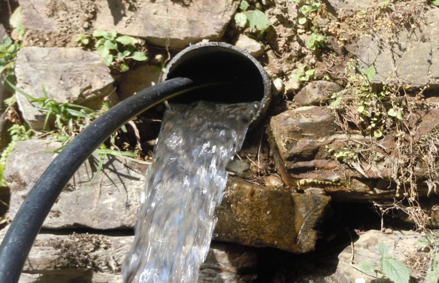
- 📍 Chamryangbesi VDC, Kavre
- 📷 Nimisha Karki
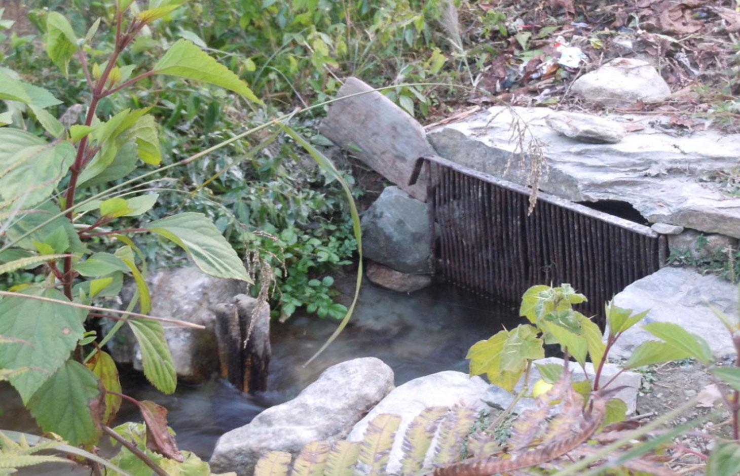
- 📍 Chamryangbesi VDC, Kavre
- 📷 Nimisha Karki
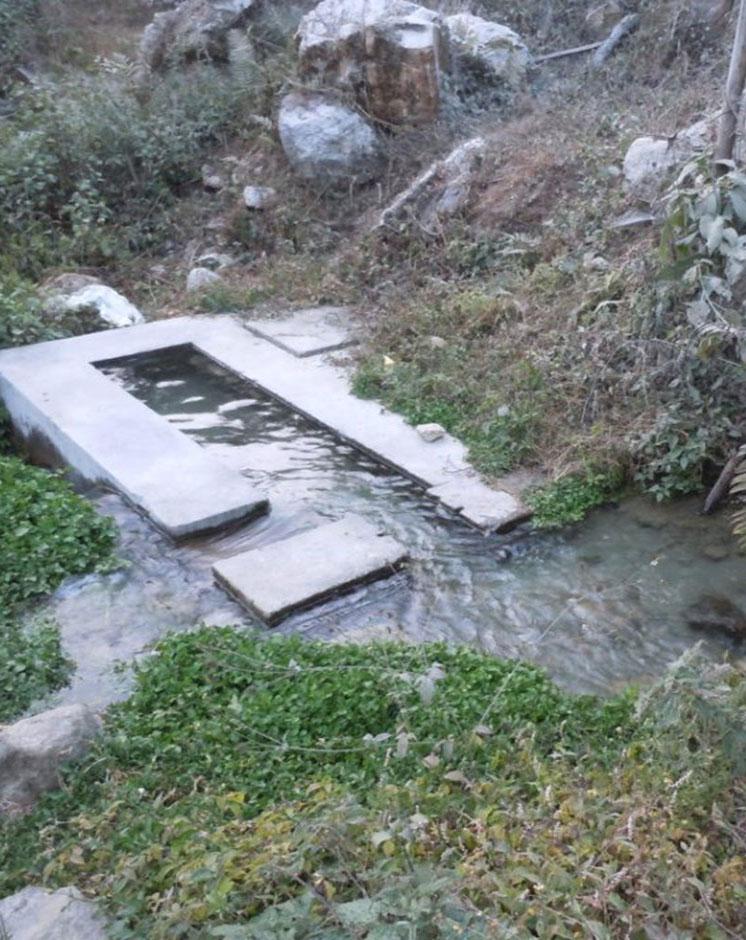
- 📍 Chamryangbesi VDC, Kavre
- 📷 Nimisha Karki