
Riverbed farming
Type: Technologies
Creation: 2015-08-13 09:57 Updated: 2019-06-03 11:39
Compilers: Shreedip Sigdel
Reviewers: David Streiff, Alexandra Gavilano
Country/ region/ locations where the Technology has been applied and which are covered by this assessment
- Country: Nepal
- Further specification of location (e.g. municipality, town, etc.), if relevant: Kanchanpur, Kailali Districts
Description of the SLM Technology
Short description of the Technology
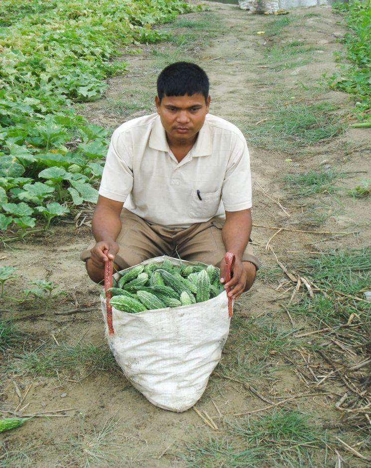
Riverbed farming can be used to increase household income and to improve the food security of landless and land-poor households in the Terai area of Nepal.
Detailed description of the Technology
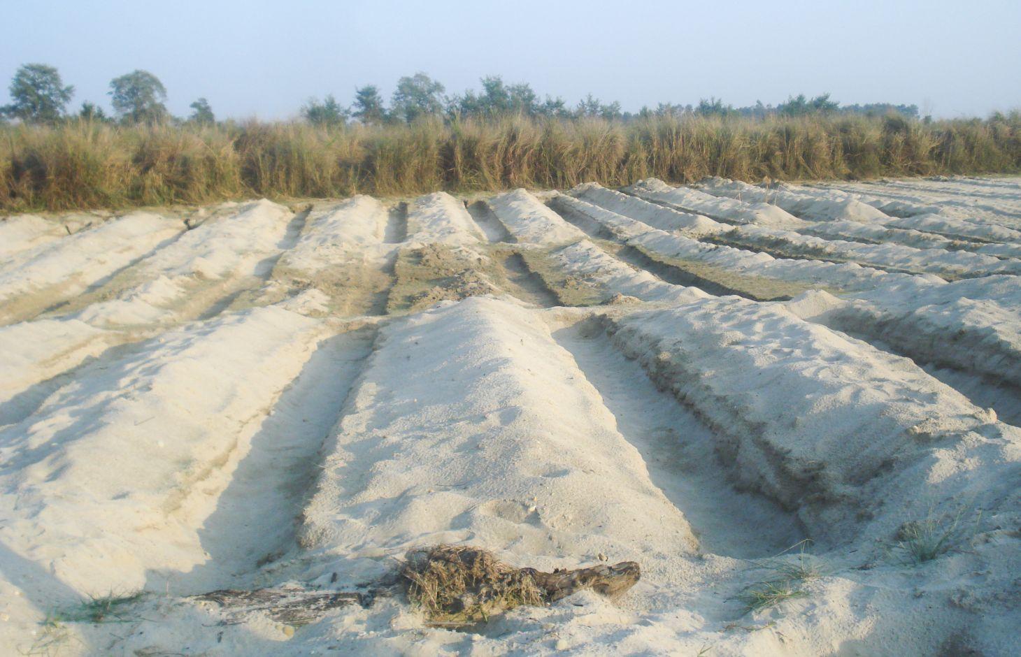
It is estimated that about 8,000 hectares of riverbed land would be suitable for agricultural cultivation in the Kailali and Kanchanpur Districts in the Western Terai areas of Nepal. After the river water recedes in the post-monsoon season, vegetables are planted in ditches dug into the seasonal sand banks; the crops are harvested before the onset of the next monsoon. In 2006, Elam Plus of HELVETAS Swiss Inter-cooperation Nepal, assessed local practices of riverbed farming and piloted an improved approach with 670 farmers, mostly from the indigenous Tharu community. During the first year they cultivated 43 hectares. Since the initial results indicated that riverbed farming could increase the target population’s income significantly, the programme was expanded from the initial two districts (Kailali and Kanchanpur) to two new districts (Banke, and Bardiya). The number of households was increased to 2000 in 2008 and 3165 in 2012 after the initiative won a Global Development Market Place award from the World Bank.
Establishment / maintenance activities and inputs: Requirements for riverbed farming:
• On average, the water table should not be lower than 1 m; when the water table is lower than this, too much labour is required.
• Plots are allocated perpendicular to the river flow in order to give each farmer access to a variety of land types (and moisture levels) suitable for different crops.
• Ditches are up to 1 m deep and 1 m wide. The length depends on how much land is available.
• A row-to-row spacing of 2–3 m (between the ditches) and plant-to-plant spacing of 0.5–1 m is required depending on the crop.
• The ditches are dug in an east-west orientation to maximize the amount of sunshine they receive and to minimise the collection of sand carried by the prevailing winds.
• Riverbed farmers can build shelters close to their plots so that they can be close at hand to fend off thieves and wild animals.
Photos of the Technology
- 📷 Juerg Merz
- 📷 Juerg Merz