
Contour Trench Bund
Type: Technologies
Creation: 2016-04-12 08:12 Updated: 2019-02-26 09:29
Compilers: Aqila Haidery
Reviewers: David Streiff, Joana Eichenberger
Country/ region/ locations where the Technology has been applied and which are covered by this assessment
- Country: Afghanistan
- Region/ State/ Province: Sar_e_Ahangaran, Bamyan center
- Map: View Map
Description of the SLM Technology
Short description of the Technology
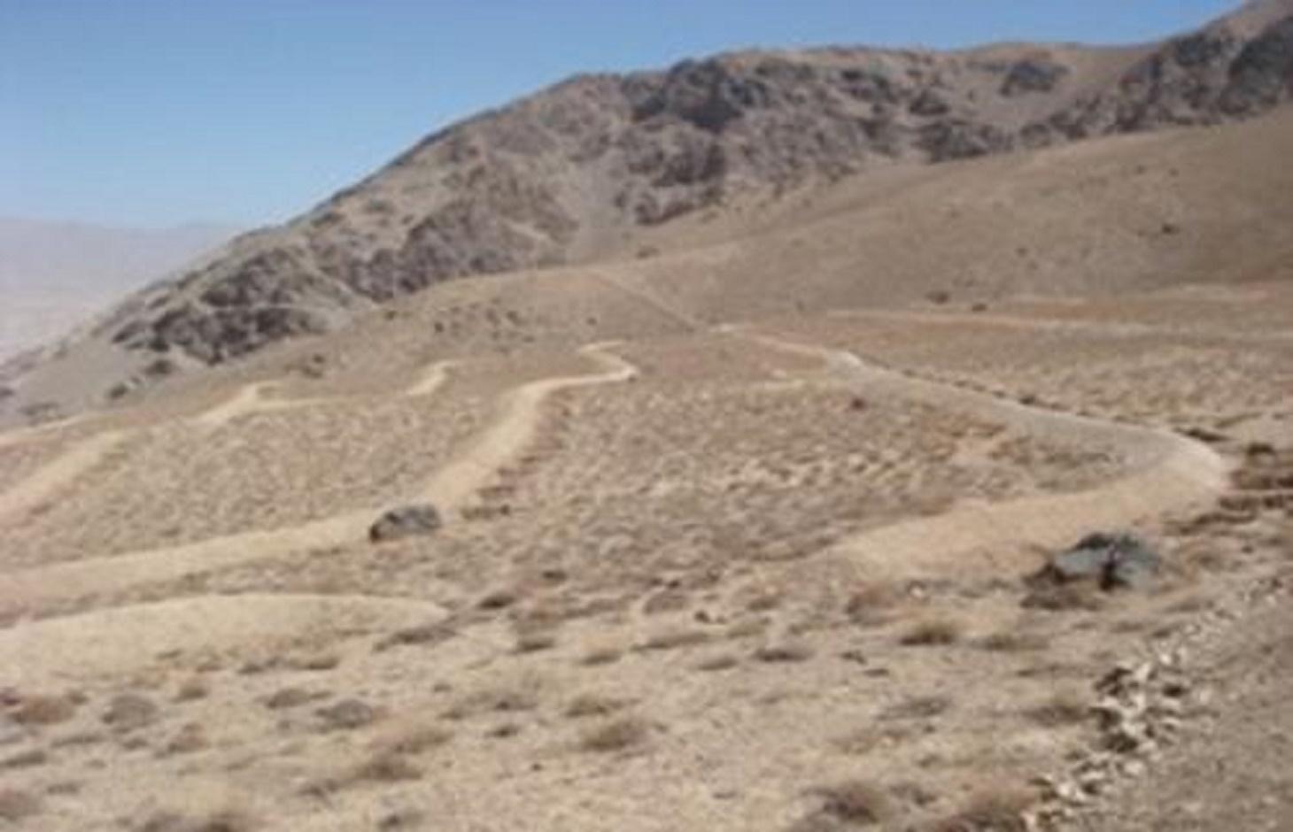
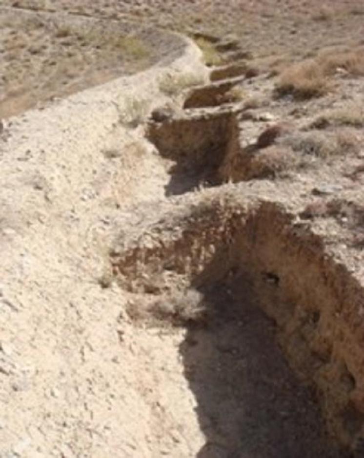
Contour trench bund applied on contour lines of moderate slope to trap run-off to improve infiltration and reduce flash floods.
Detailed description of the Technology
The Contour Trench Bund technology is documented by Sustainable Land Management
Project/HELVETAS Swiss Intercooperation with financial support of Swiss Agency for
Development and Cooperation(SDC) and close support and cooperation of the Catholic
Relief Service (CRS). The technology was applied in Sar-e Ahengaran watershed of Bamyan centre, an area of 0.08 km2 as part of a watershed project by the Catholic Relief Services (CRS). The total watershed area is 67 ha. The project started in October 2009 involving the community with funding support from USAID and CRS. The project came to an end in March 2013.
Purpose of the Technology: The main purpose of the contour trench bund technology is to reduce excessive surface runoff and improve infiltration. It also contributes to increased vegetation cover.
Establishment / maintenance activities and inputs: The main activities for this SLM technology include: site selection and technical planning in October 2009; demarcation of contour lines using A-frame and lime; and digging trenches and construction of soil bunds. The technology was established over 10 months. The project used a “Cash for Work” approach; local people were employed for construction works. Cost-wise, approximately 7,536 USD were spent on this technology (approximately 942 USD/ha) with 90% contribution from the project and 10% from the participating community. There have been no maintenance costs so far for this technology.
Dimensions of a trenches are: 0.7 m in depth, 1.2 m width, 3 m length and of the bunds: 0.45 m in height, 1.2 m in width, 100 m in length with 12 m spacing and 1.5 m vertical interval between two contour lines. Contour trenches were applied on hilly (16-30%) slopes at an altitude of 2500-3000 m. The technology is tolerant to temperature, seasonal rainfall, storms and droughts and sensitive to heavy rainfall events and floods. The soil in the watershed is sandy to loamy type, and infertile with a depth of 20-50 cm. The infiltration is medium.
The technology is part of the watershed management system. Other measures implemented included stone walls, cultivation of fodder grasses and ban on grazing and shrub cutting at the site. The land ownership (in the watershed) is communal with open access water rights. Medium scale land users, mainly men, applied the technology. Women and school children participated in meetings concerning awareness raising. There is also a watershed and pasture management committee for site management.
Natural / human environment: The annual rainfall in the area is 250-500 mm. The agro-climate is semi-arid and temperate type with the longest growing period of 180 days from April to October. The people in this area are mainly poor. 10-50 % of all income comes from off-farm activities. Access to health, market and financial services is low and education, roads, transport, drinking water and sanitation facilities are moderate. Agriculture is of mixed type, subsistence and commercial based.
Photos of the Technology
- 📍 Sar-e-Ahangaran, Bamyan center
- 🗓 2011-07-06
- 📍 Sar_e_Ahanaran, Bamyan center
- 🗓 2011-07-06