
Stone Check Walls and Check Dams for Soil and Water Conservation
Type: Technologies
Creation: 2019-07-31 14:53 Updated: 2021-06-27 15:17
Compilers: Jaclyn Bandy
Reviewers: Hanspeter Liniger
Country/ region/ locations where the Technology has been applied and which are covered by this assessment
- Country: India
- Region/ State/ Province: Uttarakhand
- Further specification of location (e.g. municipality, town, etc.), if relevant: Nakina Village, Pithoragarh Bloc
- Map: View Map
Description of the SLM Technology
Short description of the Technology
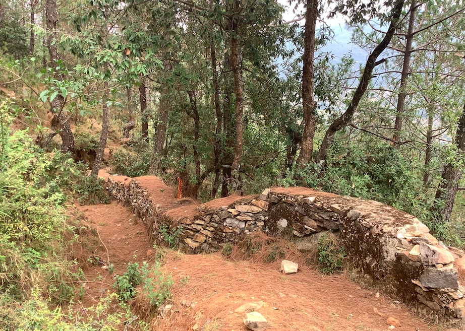
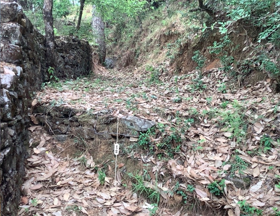
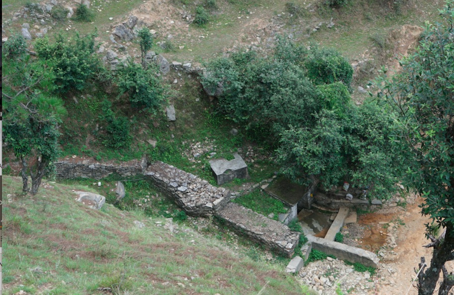
Stone Check Dams/Walls, Retainment Walls, and a Water Diversion Wall has been constructed in Nakina Village and Nakina Community Forest to help protect their settlements, agriculture land, forest land, and preserve the hilly landscape. These structures serve to reduce the runoff velocity (lowering the rate of erosion and gullying in steep slope channels) and increase infiltration for groundwater recharge.
Detailed description of the Technology
1. The technology is found in both natural and human environments (forest and settlement areas)
2. Main Characteristics: A check dam or check wall is constructed in a loose or active gully or a rill (shallow channel) that threatens to enlarge, or anywhere on a slope where there is a danger of scour from running water. The structures lower the velocity of flow. In Nakina porous check walls, check dams, and retainment walls were made out of stone gathered from the surrounding area. A porous check dam releases a portion of flow through the structure, decreases the head of flow over the spillway, and decreases the dynamic and hydrostatic forces against the check dam. Porous check dams are simple and more economical for construction.
Once stones are collected they are cut into suitable sizes and surfaces ( "dressing" of stones). The site where the technology is to be constructed is then cleared and, for check dams, the sides are sloped 1:1 (this simply refers to the ratio of the rise and run of the slope, so 1:1 means you'll have a 45 degree slope for your excavation). This is also known as the angle of repose, where the granular material of the embankment will be stable and not slump from its own weight. The base of the dam should be around 70 cm thick if it is 1 meter high. The bed of gully is excavated for foundation and dry stones are packed from that level.
3. Purposes/functions: Interrupts the flow of water and flattens the gradient of a channel, thereby reducing the velocity and inducing infiltration rather than eroding the channel. These structures not only slow flow velocity but also to distribute flows across vegetation. Despite some sedimentation resulting behind the dam, small cracks and porous spaces in the holes of the stones allow some sediment to flow through and the finer particles fill the gaps and strengthen the structure. Check dams can also be designed to create small reservoirs.
4. Major activities include identifying the appropriate site of installation, collection of construction materials, technical planning of the structure dimensions and design, manual labor, and maintenance.
5. Benefits/impacts: These structures decelerate runoff and accelerates groundwater recharging by storing water and facilitating infiltration of water into the soil
6. Like/Dislike:
Advantages
•Inexpensive and relatively easy to install given local building materials and labor availability
•Reduce velocity, prevent gully erosion and cause a high proportion of the sediment load in runoff to settle out, preventing downstream damage
•When carefully located and designed, check dams can remain as permanent installations with very minor regrading
Disadvantages
•Many of these structures have a temporary nature, and need to reconstructed or removed after significant damage
•Removal or reconstruction may be a significant cost depending on the size and design
•May kill grass linings in channels if the water level remains high after rainstorms or if there is significant sedimentation.
•May create turbulence which erodes the channel banks.
•Clogging by organic material may be a problem and hinder the structure's function
Photos of the Technology
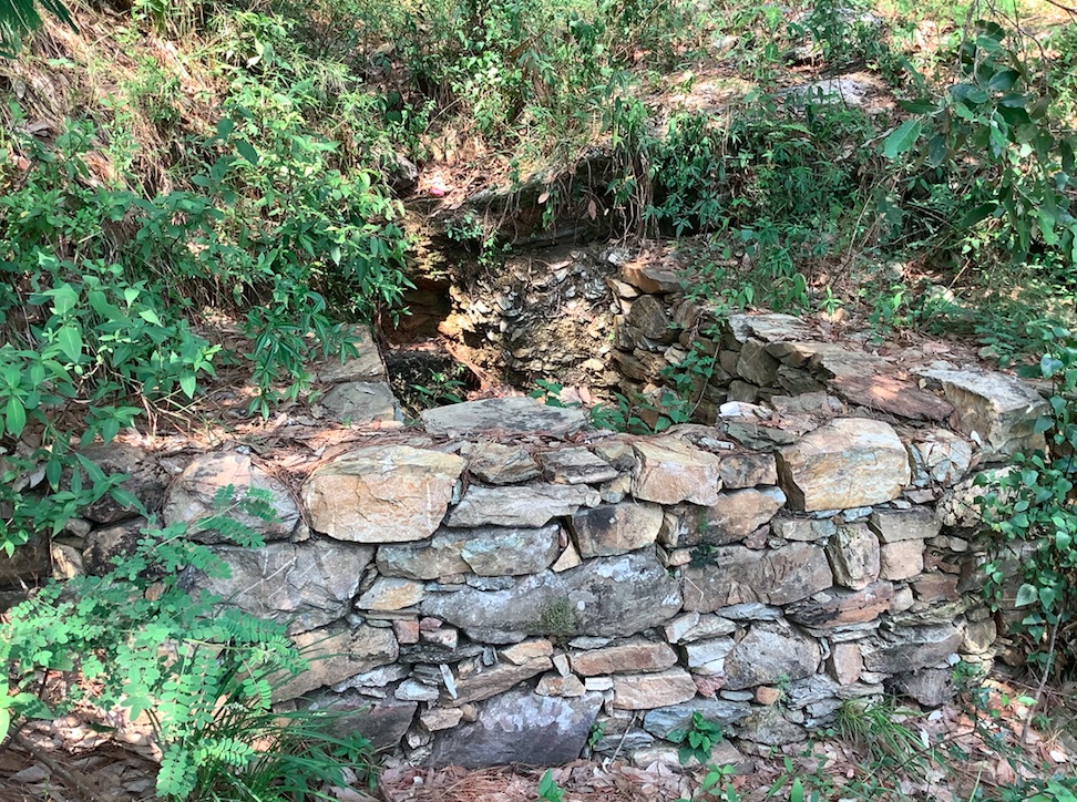
- 📍 Naikina Community Forest, Pithoragarh Bloc, Uttarakhand, India
- 📷 Jaclyn Bandy
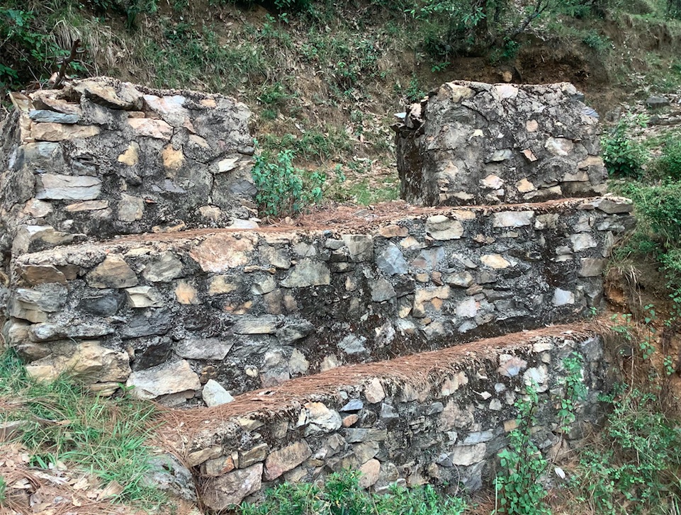
- 📍 Naikina, Pithoragarh Bloc, Uttarakhand, India
- 📷 Jaclyn Bandy
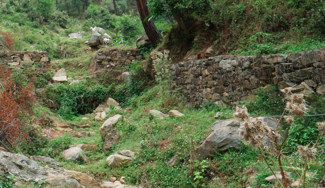
- 📍 Nakina
- 📷 Hanspeter Liniger
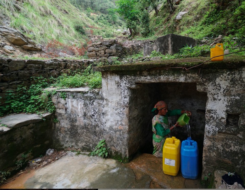
- 📍 Nakina Village
- 📷 Hanspeter Liniger
- 📍 Nakina Village
- 📷 Jaclyn Bandy
- 📍 Nakina Village
- 📷 Jaclyn Bandy
- 📍 Nakina Village
- 📷 Hanspeter