
Emergency infrastructure including shelter and linked transport infrastructure
Type: Technologies
Creation: 2016-10-26 16:10 Updated: 2019-03-05 11:50
Compilers: TUHIN SAMADDAR
Reviewers: Alexandra Gavilano, Hanspeter Liniger, Nicole Harari
Country/ region/ locations where the Technology has been applied and which are covered by this assessment
- Country: Bangladesh
- Region/ State/ Province: North-Bengal
- Further specification of location (e.g. municipality, town, etc.), if relevant: Kamarjani and Mollar Char Union (i.e. municipality) in Sadar Upazila and Haldia Union in Shaghata Upazila of Gaibandha District
- Map: View Map
Description of the SLM Technology
Short description of the Technology
Emergency infrastructure including shelter and linked transport infrastructure, consists in establishing specific flood shelters (for people and animals) including flood-proof collective water sources and communication infrastructure as well as health and school facilities that may serve at the same time as emergency shelters during floods.
Detailed description of the Technology
The technology applies to the specific context of the ‘Char’ land in Bangladesh, characterised as riverine sandy Islands along the Jamuna River. More than 80% of the land in the intervention area can be classified as 'Char' and is inhabited by 60% of the population served by the project. Every year, especially during floods, the rivers deposit huge amount of silt sediment that makes the land fertile. At the same time, river action washes away some portion of the 'Char' which at times can be quite large and has a strong impact on people's lives and livelihoods. Before the intervention, people living on 'Char' land depended on their traditional early warning mechanisms and were frequently surprised by floods that destroyed their crops and put their lives in danger. Due to recurring floods, people didn’t have the means to improve their built environment. The 'Char' land is furthermore characterised by its lack of public infrastructure and remoteness to public services.
The technology consists of setting up an emergency infrastructure and ensuring community access to these infrastructures during times of floods. It has to be understood in close interrelation with the approach of setting up an early warning system. The emergency infrastructure includes specific flood shelters (for people and animals), flood-proof collective water sources and sanitation systems, transport infrastructure such as foot bridges and elevated rural roads, as well as flood-proof health and school facilities that also serve as emergency shelters during floods. The flood shelters are built on a raised bed of soil and located at sites selected by the communities that are relatively better protected from flood and river erosion within the 'Chars'. The purpose of the technology is to ensure safety of life and protection of assets during times of emergency and also to mitigate sufferings related to floods. The flood shelter is an elevated plane land which is on an average 220 square feet by size and at least five feet high from the existing ground level. The site is selected by the community and should be connected through an elevated road to the nearest community. This arrangement helps people to get easy access during times of floods. The shelter has collective hygienic latrine facilities and safe water sources. People generally dismantle their housing while evacuating and reinstall it on the flood shelter.
The major activities include facilitating the development of community-led risk reduction action plans and their implementation through community participation and engagement of local governance institutions. This includes maintenance of the built infrastructure as the joint responsibility of the community and the local government. Land use, especially sowing and harvesting, is increasingly linked to flood related forecasting measures which has led to significant adaptation in the timing of farming activities. This coupled with the creation and access to emergency infrastructure allows for a relatively safe and healthy living. The adopted technology and approach has led to adapted livelihoods, reduced health costs and increased income. The technology has furthermore led to mainstreaming disaster risk management in policies and approach of local government institutions. Increasingly the local government’s cash and food for work programmes are targeting establishment and/or reinforcement of emergency infrastructure that can cater to larger population. Increased investments are made especially towards flood shelters and improving communication and access to emergency infrastructure. Since the technology is based on local knowledge and has been developed in consultation with the involved communities, it is generally well accepted with a fair degree of ownership and involvement. However, parts of the region are also prone to river erosion and this has a destructive impact on built infrastructures. The technology does not assure any safeguard against this form of uncertain river action.
Photos of the Technology
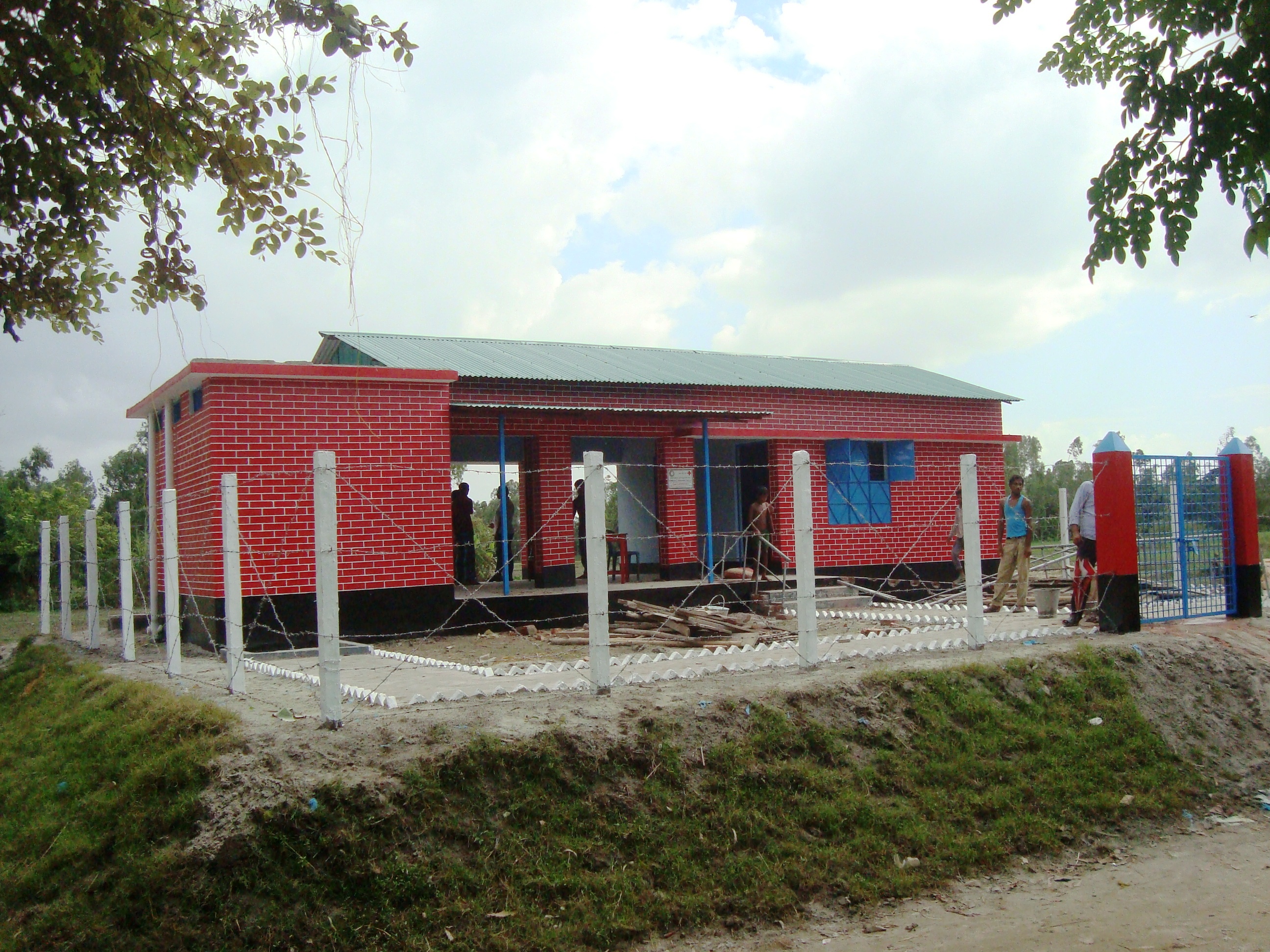
- 📍 Kundarpara village, Kamarjani union, Gaibandha district
- 📷 Tuhin Samaddar
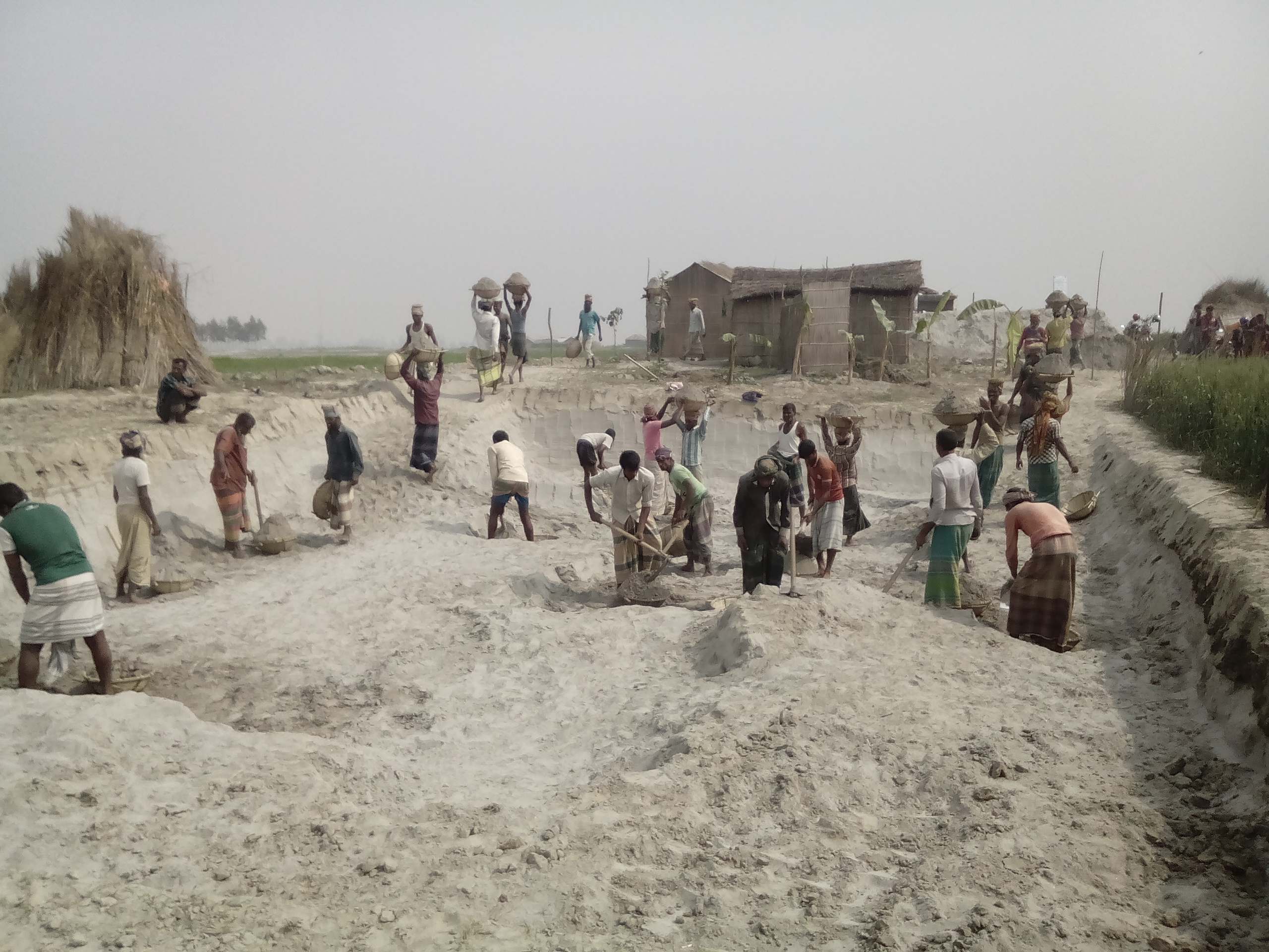
- 📍 Patilbari village in Haldia union of Shaghata upazila, Gaibandha district
- 🗓 2016-07-02
- 📷 Tuhin Samaddar
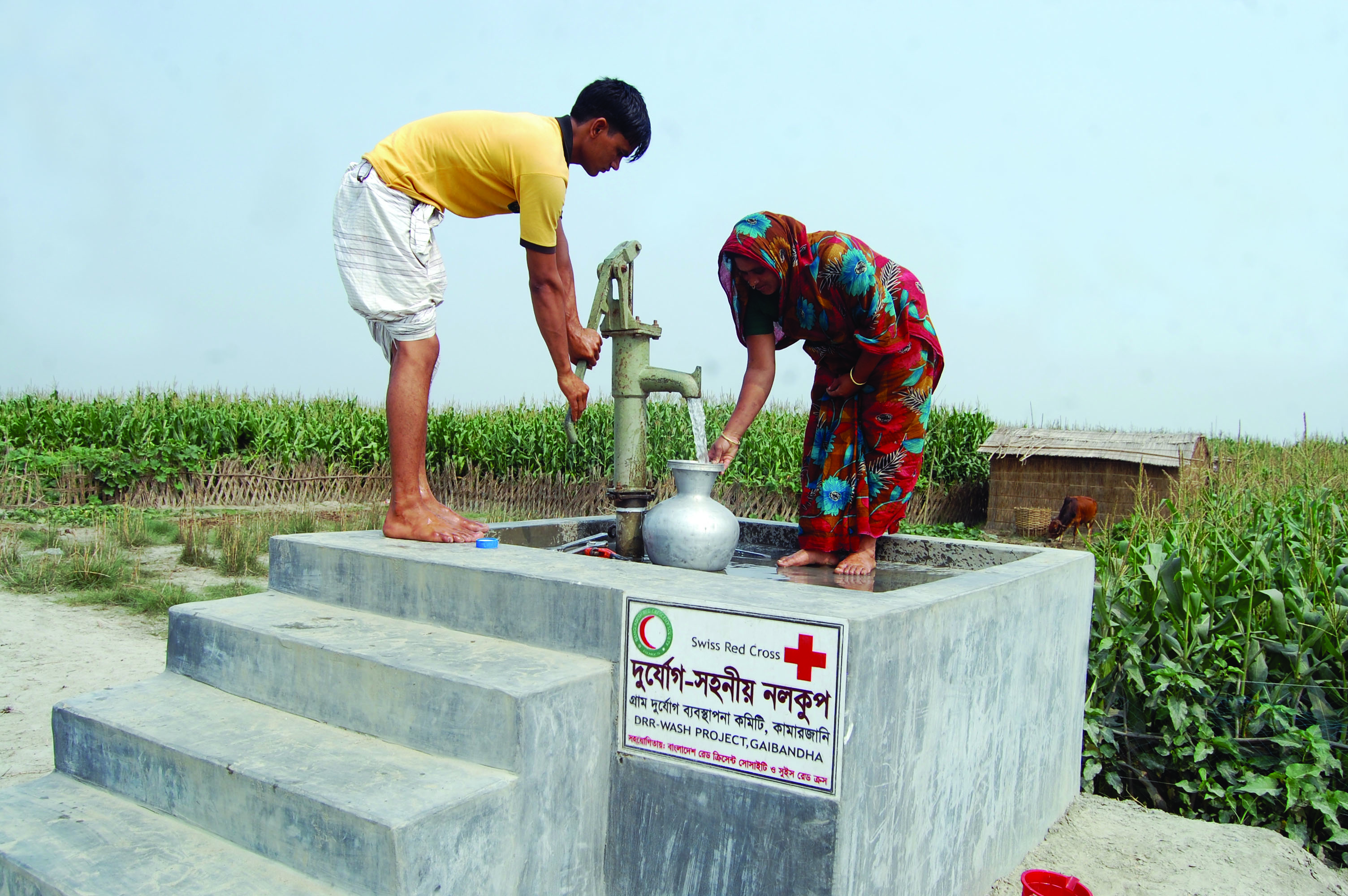
- 📍 Chithulia Deghor village, Mollar Char union, Gaibandha district
- 📷 Tuhin Samaddar
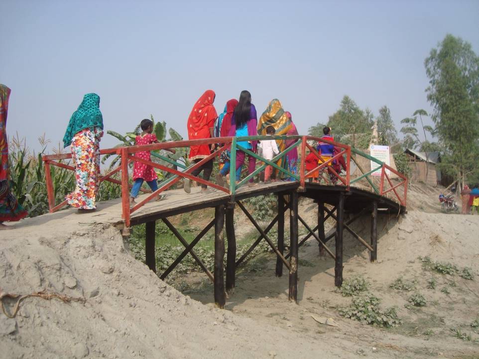
- 📍 Hashdhora Village in Mollar Char union of Sadar upazila, Gaibandha district
- 🗓 2016-12-01
- 📷 Tuhin Samaddar